Partly Sunny Days; A Few Scattered Storms Around
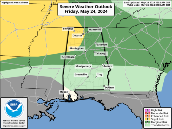
SUMMER-LIKE PATTERN: We note a few sprinkles across Alabama early this morning, but most of the state is dry with temperatures in the 70s. The high today will be close to 90 degrees with mix of sun and clouds; we will maintain the chance of a few scattered showers and thunderstorms through early tonight. Where storms do form, they will be strong over the northern half of the state with potential for some small hail and gusty winds. The chance of any one spot getting wet over North Alabama is 30-40 percent, and around 20 percent for the southern counties.
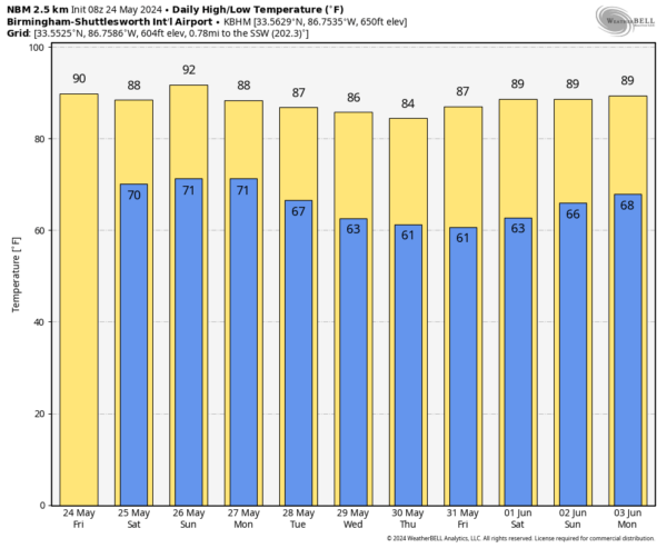
The weather won’t change much over the Memorial Day weekend. Partly sunny days with the chance of a passing shower or storm in spots each day. While much of the weekend will be dry, keep in mind a few storms could be strong… “when thunder roars, go indoors!”. Higher chance of seeing a shower or storm will remain over the northern half of the state, and highs will remain in the 87-92 degree range.
Showers and storms will be more numerous Monday night as a cold front pushes into the state.
REST OF NEXT WEEK: A lingering shower is possible in a few spots Tuesday, but the rest of the week will be dry with lower humidity and cooler nights. Cooler spots over North Alabama will dip into the 50s by Wednesday and Thursday morning. See the video briefing for maps, graphics, and more details.
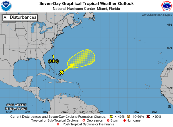
TROPICS: A trough of low pressure is producing disorganized showers and thunderstorms a couple of hundred miles to the northeast of the central Bahamas. An area of low pressure is expected to form within this system roughly halfway between Bermuda and Hispaniola later today. Although environmental conditions are not conducive, some slight subtropical or tropical development is possible over the next couple of days while the system moves northeastward. Chance of development here is only 10 percent.
ON THIS DATE IN 1973: An F4 tornado tore through the small town of Union City, Oklahoma, killing two and injuring four others. This tornado was the first storm to be studied in detail by the National Severe Storms Laboratory Doppler Radar Unit at Norman, OK and an armada of researchers in the field. Research of the radar data from the storm would lead to the discovery of a “TVS,” or Tornado Vortex Signature.
We are on a holiday schedule, so just one video briefing today, but I will post fresh forecast notes here this afternoon. Enjoy the day!
Category: Alabama's Weather, ALL POSTS, Weather Xtreme Videos


