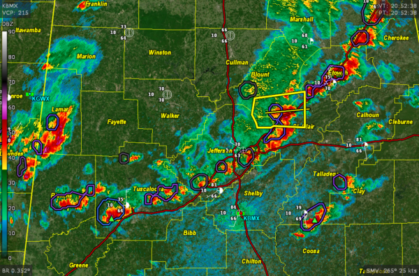
Storms Moving Through Birmingham Metro
Extensive thunderstorms now in the I-59 Corridor from Fort Payne and Valley Head down to Gadsden, then down to Ashville and Argo through western St. Clair and eastern Jefferson, then from western Birmingham back to Bessemer and McCalla, with additional storms stretching down to Tuscaloosa.
Individual storms are moving east at 25-30 mph while the arc of storms is sliding southeast.
Additional heavy storms are forming now from near Sylacauga to Pell City up into Calhoun County.
Back to the west, storms are firing in Lamar County, Alabama and Lowndes County, Mississippi.
Be alert for very heavy rain, lightning, gusty winds, and some hail.
The storms are a little ahead of schedule, but that is more good news for tonight’s game at Protective Stadium between the undeafted Birmingham Stallions and the Houston Roughnecks. Kickoff is at 7.
Category: Alabama's Weather, ALL POSTS, Severe Weather


