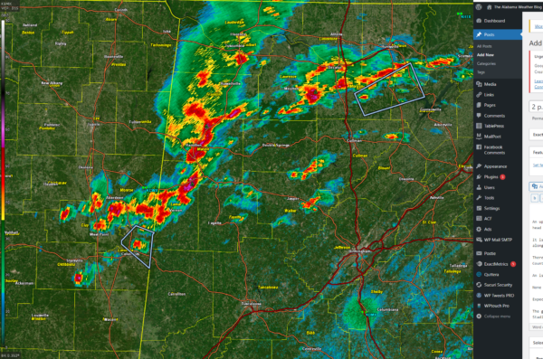
2 p.m. Alabama Weather Update
An upper low over western Tennessee appears to be spinning up a mesoscale convective vortex over Northwest Alabama at this hour. The comma head appears to be over Franklin, Winston, and Lawrence Counties.
It is pushing an arc of thunderstorms from Winston down through northwestern Walker, through Fayette and Lamar Counties. Storms are forming along the tail end of the disturbance, affecting Lowndes County, Mississippi, near Columbus.
There are other storms moving through the Huntsville/Decatur area with isolated storms over the higher elevations of Jackson and DeKalb Counties.
An isolated strong storm is in southwestern Blount County. It is near Smoke Rise and Hayden. It will move east northeast toward Locust Fork.
None of the storms are severe at this time, but a couple of isolated severe reports are likely.
Expect heavy rain, small hail, and some damaging wind gusts as the complex tracks east and eventually southeast.
The good news is that the storms should move through the Birmingham Metro around 5-530 p.m. giving us plenty of time to get iunto Protective Stadium ahead of the undefeated Birmingham Stallions game.
Category: Alabama's Weather, ALL POSTS, Severe Weather


