Rain Possible Statewide Tonight/Tomorrow
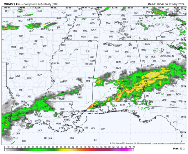
RADAR CHECK: Today has been a case of feast or famine when it comes to rain for Alabama. Most of the rain today has been south of a line from Demopolis to Clanton to Lafayette; radar suggests parts of Wilcox County have received over five inches. The northern half of the state has been basically dry with only a few sprinkles.
THE WEEKEND: Occasional showers and thunderstorms are likely statewide tonight and tomorrow. Not a continuous rain, and like today, the rain distribution won’t be very even. But, if you have an outdoor event planned be ready for a passing shower or thunderstorm at just about any hour.
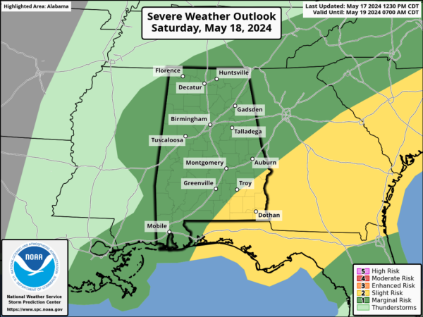
SPC has defined a “slight risk” (level 2/5) of severe thunderstorms for Southeast Alabama tomorrow; there is a “marginal risk” (level 1/5) for the rest of the state.
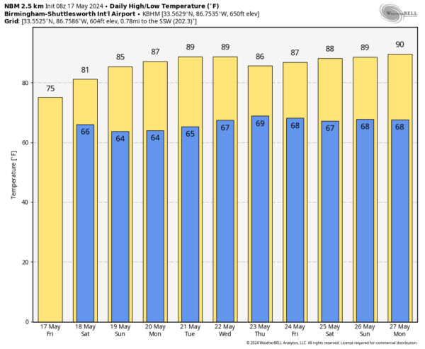
Stronger thunderstorms tomorrow could produce some hail and gusty winds; the setup doesn’t favor tornadoes. The high tomorrow will be in the low 80s.
Most of the day Sunday will be dry with a partly sunny sky; just a small risk of a morning shower as an upper trough passes overhead. The high Sunday will be in the mid 80s.
NEXT WEEK: The weather looks warm and generally dry with highs in the 85-90 degree range. A few scattered showers will be possible over North Alabama Thursday as weak front drifts into the state from the north… See the video briefing for maps, graphics, and more details.
ON THIS DATE IN 1896: An estimated F5 tornado tracked 100 miles through northeastern Kansas and extreme southeastern Nebraska. Seneca, Oneida, Sabetha, and Reserve, Kansas sustained severe damage. While passing through Reserve, the tornado was 2 miles wide. 25 people were killed, and 200 were injured.
Look for my next video briefing here by 6:00 a.m. Monday… enjoy the weekend!
Category: Alabama's Weather, ALL POSTS, Weather Xtreme Videos


