
Rain/Storms Return Friday/Friday Night
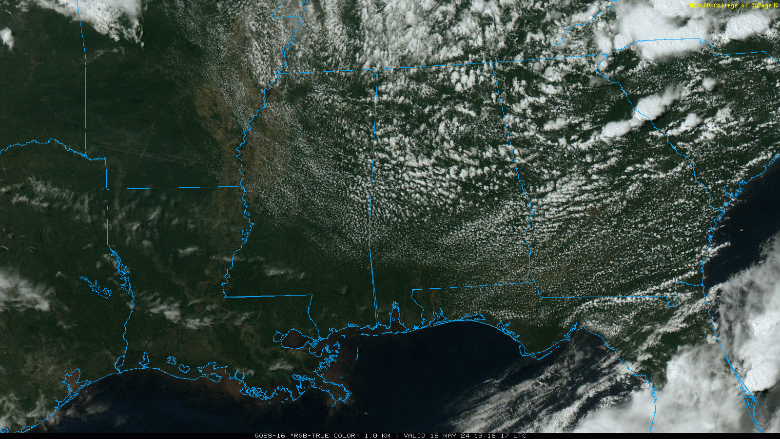
QUIET WEATHER: We note a few small, isolated showers across Northeast Alabama this afternoon, otherwise the sky is partly sunny with temperatures in the 70s over the northern half of the state and 80 over the southern counties. Tonight will be mostly fair with a low in the 60-65 degree range.
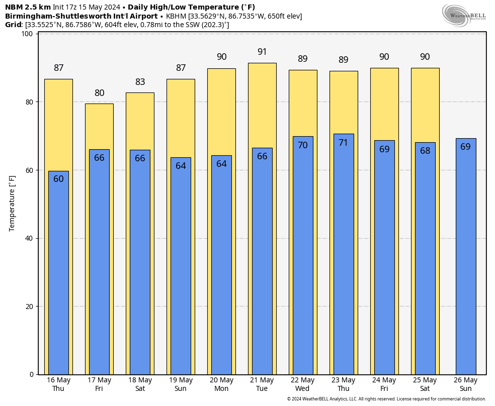
Tomorrow will be a mostly sunny day with a high in the mid to upper 80s.
FRIDAY AND THE WEEKEND: Rain returns to Alabama during the day Friday ahead of the next storm system. While a shower is possible Friday morning, the more widespread rain will come Friday afternoon and Friday night. SPC has defined a “slight risk” (level 2/5) of severe thunderstorms for parts of West and Southwest Alabama… the rest of the state is in a “marginal risk” (level 1/5).
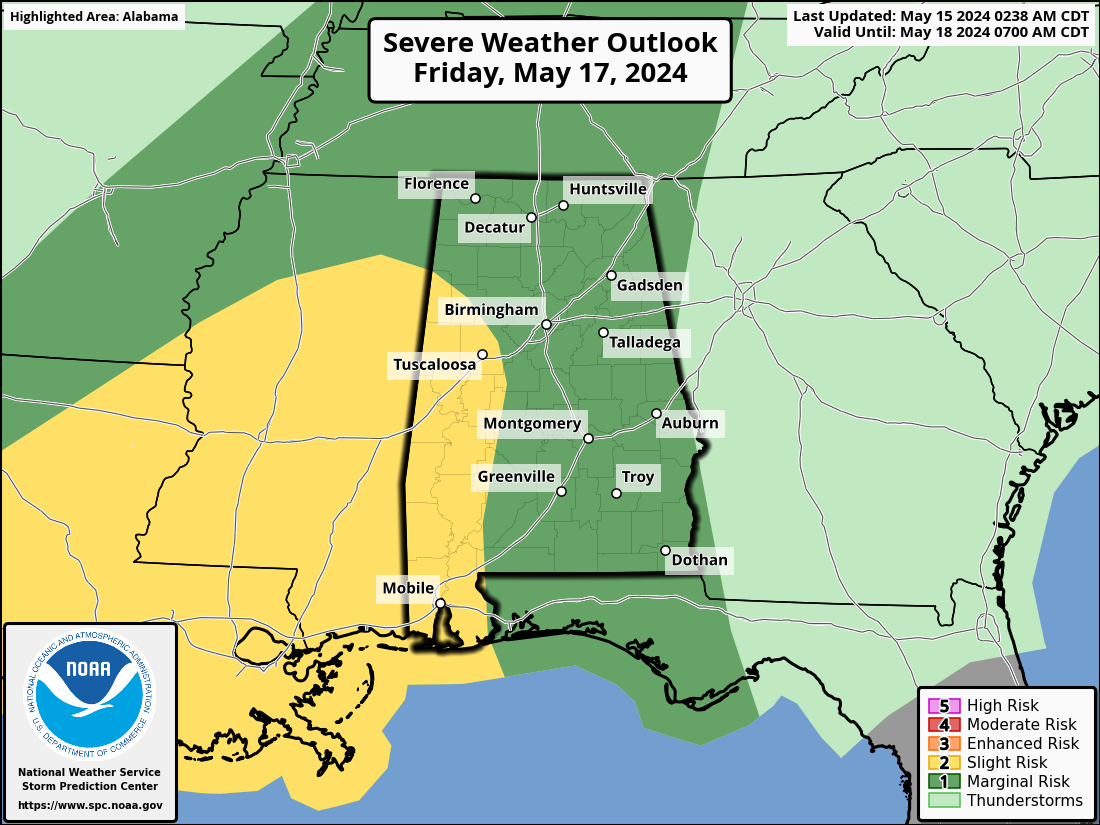
There is a good bit of uncertainty involving how the storm environment evolves. For now it looks like the higher chance of severe thunderstorms will be over the southern half of the state, where better instability values will be in place. The main threats will come from strong, potentially damaging straight line winds and hail, but an isolated tornado is certainly possible (mainly over South Alabama).
Rain could also be heavy at times late Friday and Friday night, some flooding issues could develop over the southern half of the state.

The larger rain mass should move out of the state by midday Saturday… we expect just a few lingering, scattered showers Saturday afternoon. The high Friday will be close to 80, followed bu low 80s Saturday.
Sunday will be a sunny, warm day with a high between 85 and 89 degrees.
NEXT WEEK: Global models suggest some risk of isolated showers Wednesday over the northern half of the state, otherwise the week looks dry. It will be the hottest week so far this year with afternoon temperatures reaching the low 90s on most days. See the video briefing for maps, graphics, and more details.
ON THIS DATE IN 1957: An F4 tornado killed 20 people in Silverton, Texas. A 5,000-pound gasoline storage tank was reportedly carried 1.5 miles and dropped into a lake.
ON THIS DATE IN 1968: An F5 tornado moved through Butler, Chickasaw, Floyd, Franklin, and Howard Counties in northeast Iowa, killing 13 people.
Look for the next video briefing here by 6:00 a.m. tomorrow…
Category: Alabama's Weather, ALL POSTS, Weather Xtreme Videos
About the Author (Author Profile)
James Spann is one of the most recognized and trusted television meteorologists in the industry. He holds the AMS CCM designation and television seals from the AMS and NWA. He is a past winner of the Broadcast Meteorologist of the Year from both professional organizations.Subscribe
If you enjoyed this article, subscribe to receive more just like it.


