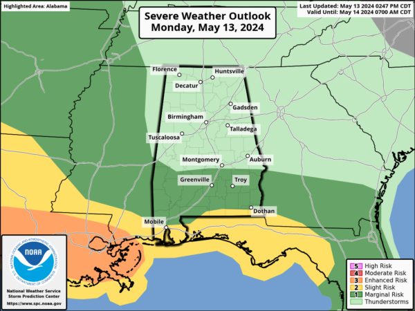
Severe Weather Threat for Central Alabama Removed for Tonight; Isolated Severe Storm Possible Tomorrow
Residents in North and Central Alabama can breathe a sigh of relief as the threat of severe storms continues to diminish this afternoon. Most severe weather is now expected to stay concentrated along the Gulf Coast, with the primary period of activity occurring tonight through early Tuesday morning. While a few storms might still pop up in our area on Tuesday afternoon, the likelihood of them turning severe has notably decreased compared to earlier predictions.
We have now removed any mention of severe storms occurring overnight across Central Alabama. Additionally, the risk of localized flash flooding has been significantly reduced, with the heaviest rains anticipated to remain along the Gulf Coast.
For those in Central Alabama, it’s still wise to stay prepared on Tuesday afternoon. The weather could bring isolated storms capable of producing damaging winds up to 60 mph and quarter-sized hail. While the overall severe weather risk has lessened, it’s always a good eye to keep an eye on the sky since, as we always say, when it comes to storms in Alabama, expect the unexpected.
Category: Alabama's Weather, ALL POSTS, Severe Weather


