Midday Nowcast: Rainy Days and Mondays
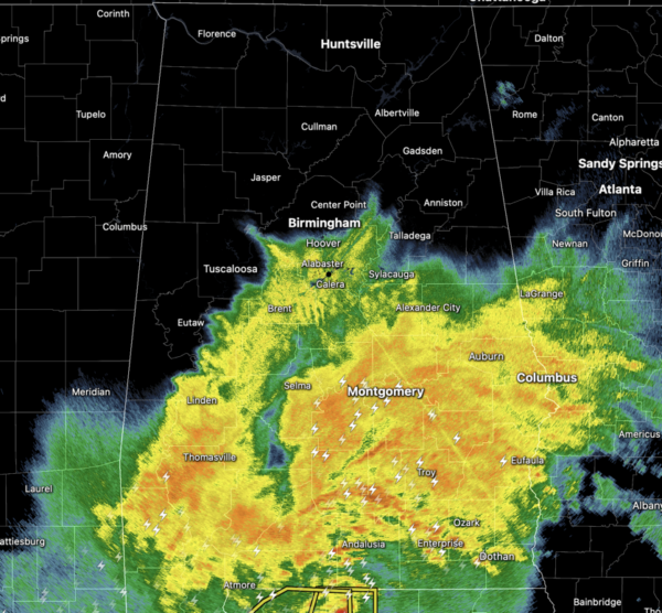
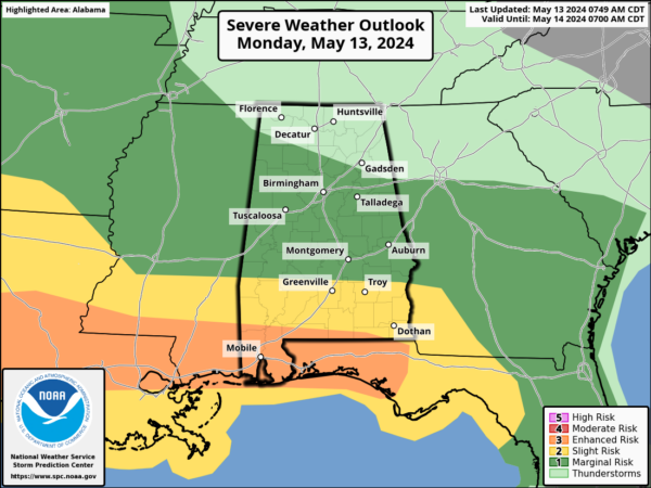
RAINY DAYS AND MONDAYS: Just like the 1973 Carpenter’s song says, they really get me down, especially after a busy holiday weekend celebrating with mom. Through the morning hours, we have been dealing with a widespread, mass of rain falling across the state of Alabama. Stronger storms and the heavy rainfall today will remain across the southern sections of the state where some severe weather continues to be possible.
Additionally, a flood watch is in effect for the southern third of Alabama. The clouds and rain are keeping our temperatures below average with only 70s this afternoon. Through the afternoon and evening, most of the rain across the northern half of state will wind down, and we should be generally dry as the rain remains to the south.
BIRMINGHAM ALMANAC: For May 13th, the average high for Birmingham is 81° and the average low is 60°. The record high is 95° set in 1962, while the record low is 38° set in 1960. We average 0.15” of precipitation on this date, and the record value is 3.81” set in 1918.
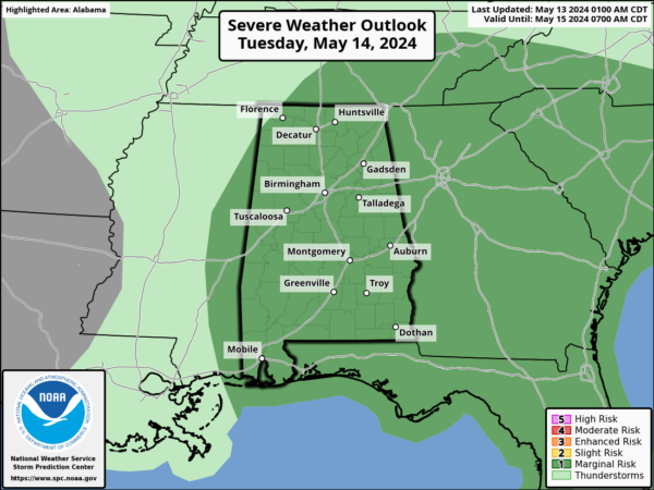
MORE RAIN AND STORMS TOMORROW: The weather stays unsettled tomorrow with a good chance of showers and storms by afternoon into the evening hours. Not an all-day rain, but where the storms form they could be strong with potential for some small hail and gusty winds. A “marginal risk” (level 1/5) covers all of Alabama. Tomorrow will feature highs closer to 80° across the northern half of the state.
A COUPLE OF DRY DAYS: Drier air moves into Alabama Wednesday and Wednesday and Thursday will be mainly dry. There will be a few isolated showers over the Tennessee Valley, the rest of the state will be dry. Highs these two days will range from the low to mid 80s with more sun than clouds.
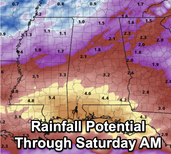
FRIDAY AND THE WEEKEND: Rain returns to Alabama Friday as a surface low approaches; the rain could be heavy at times through Friday night, but with the low passing to the south of us, any risk of severe storms will be confined to areas close to the Gulf Coast. Rainfall potential through Saturday morning will be 4-7 inch range across South Alabama with 1-2 inch amounts for the northern half of the state.
Model madness as we head into the weekend, and confidence in the weekend forecast is low at this time and will change in the coming days. For now we will mention a chance of lingering showers Saturday, followed by a trend toward drier weather Sunday. Highs will be in the low to mid 80s.
NEXT WEEK: An upper ridge will build over the region, and for now a decent part of next week looks dry with highs in the mid to upper 80s. I would not be surprised to see more and more 90s starting to show up on the maps next week as well.
BEACH FORECAST CENTER: Get the latest weather and rip current forecasts for the beaches from Fort Morgan to Panama City on our Beach Forecast Center page. There, you can select the forecast of the region that you are interested in visiting.
WORLD TEMPERATURE EXTREMES: Over the last 24 hours, the highest observation outside the U.S. was 116.8F at Matam, Senegal. The lowest observation was -90.0F at Dome C, Antarctica.
CONTIGUOUS TEMPERATURE EXTREMES: Over the last 24 hours, the highest observation was 105F at Death Valley, CA. The lowest observation was 23F at Berthoud Pass and Lake George, CO as well as Angel Fire, NM.
Category: Alabama's Weather, ALL POSTS


