Strong Storms Surging Southeastward
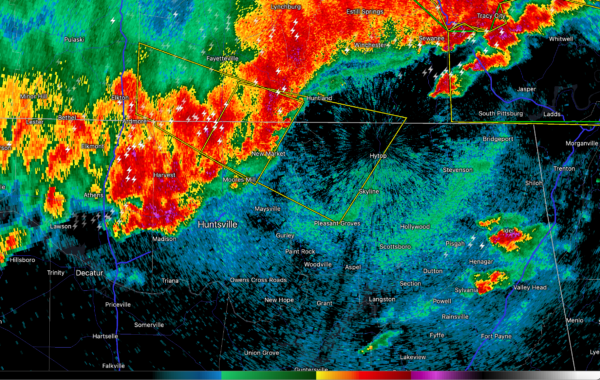
Strong thunderstorms are over the Tennesse Valley of North Alabama this morning.
The strongest is over northern Madison County from Hazel Green to New Market. Winds look really strong, so the damaging wind potential is high. There is good low-level helicity, so a tornado can’t be ruled out, even though we see no signs of one developing immediately.
Severe thunderstorm warning now for parts of Madison and Jackson Counties.
The line of storms now extends from Cherokee to Muscle Shoals, to Athens, Huntsville, and New Market. It is pushing slowly to the southeast.
Heavy rain, lightning, gusty winds and small hail will accompany the storms.
Category: Alabama's Weather, ALL POSTS, Severe Weather


