Midday Nowcast: Storms on the Way
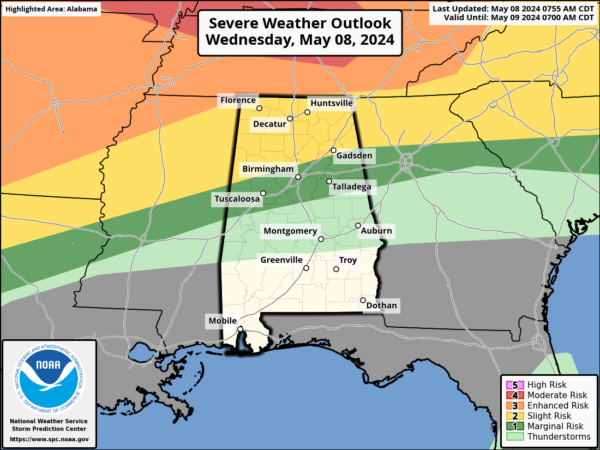
It is another very warm day with temperatures in the upper 80s and lower 90s and a few isolated storms are possible this afternoon, but most locations will remain dry. Tonight, after midnight, an organized cluster of strong and severe storms will move into the Tennessee Valley and drop south through the morning hours.
These storms will be capable of producing strong winds and some hail; they will reach the I-59/20 corridor (Birmingham, Tuscaloosa, Anniston, Gadsden) around mid-morning. Then, by afternoon, the storms will be mainly over South Alabama. For the reason, the SPC maintains a “slight risk” (level 2 of 5) threat of severe storms across much of Alabama.
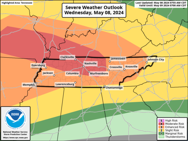
We note the SPC has a “moderate risk” (level 4 of 5) for severe storms to the north of Alabama today across portions of Missouri, Illinois, Kentucky, and Tennessee. Numerous severe thunderstorms appear likely in these areas today. All severe hazards, including tornadoes, very large to giant hail, and potentially significant damaging winds are possible. Some of the tornadoes may be strong.
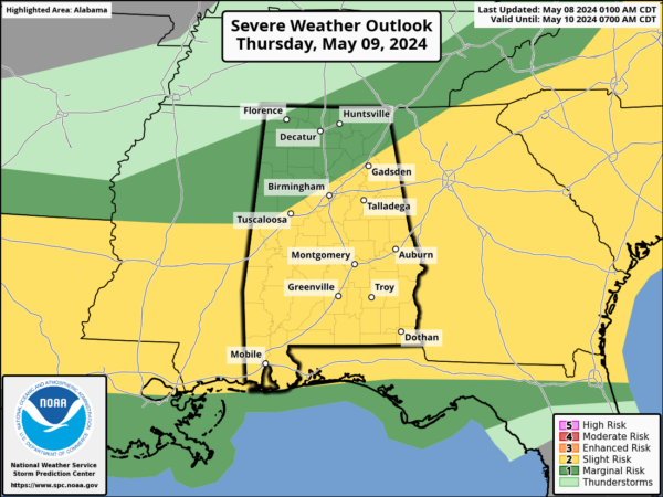
Tomorrow afternoon and evening, as a cold front drops into the state, more strong storms are possible and these storms will be capable of producing small hail and gusty winds. However, the the overall severe weather threat with this activity is not especially high since the air will be worked over by the first round of rain and and storms earlier in the day.
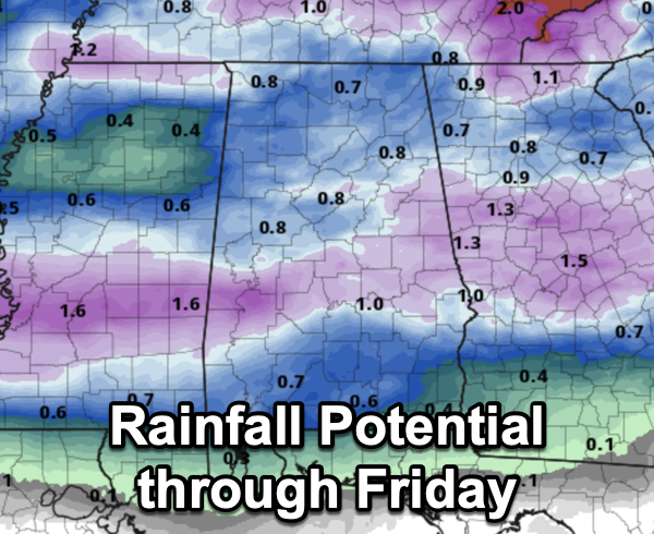
The overall tornado threat is very low tomorrow, but not zero. Rainfall amounts for much of the state will be in the 0.50”-1.00” range, and flooding is not expected.
BIRMINGHAM ALMANAC: For May 8th, the average high for Birmingham is 80° and the average low is 59°. The record high is 92° set in 1986, while the record low is 41° set in 1960. We average 0.16” of precipitation on this date, and the record value is 2.92” set in 1969.
MARVELOUS MOTHER’S DAY WEEKEND: A refreshing, cool, dry airmass will drop into Alabama Friday, setting the stage for sunny, pleasant days and clear, cool nights all weekend long. The sky will clear through the day on Friday and will remain mainly clear through the weekend. We are forecasting highs mostly in the 70s, with lows in the 50s. Colder spots across North Alabama could easily dip into the 40s Saturday morning.
NEXT WEEK: Clouds ands scattered shower return Monday, and the week looks rather unsettled with showers and perhaps a few storms possible each day. Highs will be mostly in the low 80s and it will be rather muggy.
BEACH FORECAST CENTER: Get the latest weather and rip current forecasts for the beaches from Fort Morgan to Panama City on our Beach Forecast Center page. There, you can select the forecast of the region that you are interested in visiting.
WORLD TEMPERATURE EXTREMES: Over the last 24 hours, the highest observation outside the U.S. was 116.6F at Nawabshah, Pakistan. The lowest observation was -104.1F at Concordia, Antarctica.
CONTIGUOUS TEMPERATURE EXTREMES: Over the last 24 hours, the highest observation was 105F at Rio Grande Village, TX. The lowest observation was 5F at Berthoud Pass, CO.
Category: Alabama's Weather, ALL POSTS


