The Saturday Briefing — A Very Nice Weekend; Clouds May Upset Solar Eclipse Fans
This Saturday is shaping up to be a great one across Central Alabama, starting off a bit chilly but warming up nicely. Expect mostly sunny skies and highs ranging from the lower 60s to the lower 70s. Tonight will be clear and cool, with lows in the lower to mid 40s.
Sunday brings a significant warm-up as southerly winds increase humidity ahead of an approaching trough and front from the west. Clouds will increase late in the day, possibly bringing a few showers overnight. Highs will be in the mid to upper 70s.
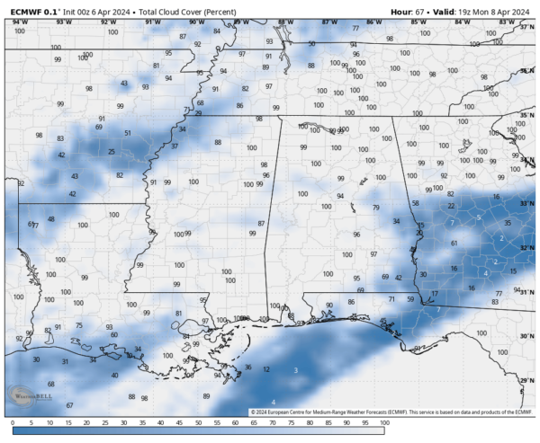
Unfortunately, Monday’s solar eclipse viewing might be hampered by cloudy to overcast skies and showers as the front stalls over the region due to a ridge along the East Coast. Temperatures will range from the lower 70s to lower 80s.
Tuesday continues with scattered showers and thunderstorms as the front shifts northward as a warm front. Temperatures will stay cooler until the warm front passes, with highs in the upper 60s to upper 70s.
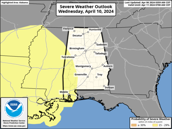
Wednesday maintains the wet pattern, with scattered to numerous showers and storms, especially in the first half of the day. Some heavy rainfall is possible, potentially leading to flooding, and there’s a slight risk of severe storms in our western and southwestern areas. Highs will be in the mid 70s to lower 80s.
Thursday keeps rain and storms likely throughout the day, with a slightly more stable atmosphere compared to Wednesday. Highs will be in the 70s.
By Friday, the rain clears out, and drier conditions with mostly sunny skies return. Highs will range from the upper 60s to mid 70s as ridging builds in from the west.
Category: Alabama's Weather, ALL POSTS, Severe Weather, Weather Xtreme Videos


