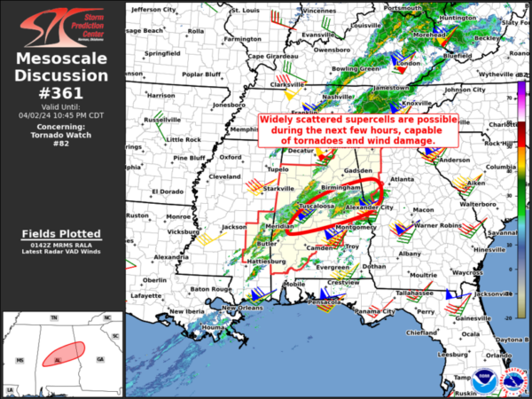
Monitoring the Risk of Severe Storms: Potential for Tornadoes & Damaging Winds
The latest update indicates that a cluster of strong thunderstorms over west-central Alabama may intensify in the next hour or two, posing a risk of a few tornadoes and wind damage. Here are the key points:
• Areas Affected: Central Alabama into western Georgia.
• Concern: Tornado Watch 82 remains in effect.
• Timeframe: Valid from 9:43 PM to 10:45 PM local time.
• Summary: The severe weather threat continues for the mentioned watch area.
• Discussion: A cluster of thunderstorms that originated in southeast Mississippi has now moved into west-central and southwest Alabama. The air mass ahead of these storms is moistening, with dewpoints in the mid-60s now extending as far north as Birmingham. An intensifying southerly low-level jet is focusing across southern and central Alabama. Hodographs from various radar sites show large, looping shear profiles with significant storm-relative helicity values. While a deep warm layer from 0-4km has limited updraft strength so far, model guidance suggests this layer may cool somewhat in the next 1-2 hours, allowing for more robust convection. The HRRR and recent WoFS runs highlight the corridor from the current storms eastward to the south of Birmingham toward the western Atlanta suburbs as having a relatively greater threat for severe storms, including a few tornadoes, in the next few hours.
Residents in these areas should stay vigilant, monitor local weather updates, and follow any advisories or warnings.
The good news is that 5 Central Alabama counties, including Fayette, Lamar, Marion, Pickens, and Winston counties, have been removed from the Tornado Watch as the threat of severe storms has ended for those locations.
Category: Alabama's Weather, ALL POSTS, Severe Weather


