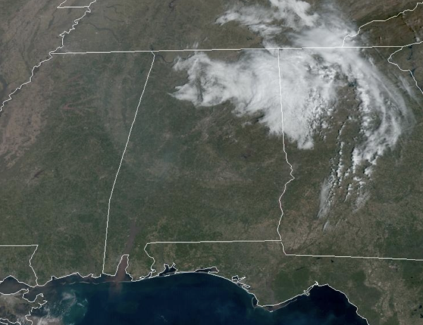
Midday Nowcast: Warming Trend Underway
It was another frosty start to the day, but the warming trend really begins today. Today is featuring widespread 60s, while low 70s are expected tomorrow and Thursday. We are seeing a feature pushing through North Alabama and North Georgia today, that has brought some clouds, but these clouds will continue to exit the state this afternoon. The next couple of days will feature plenty of sunshine, and it will give us a nice taste of spring-like weather across Alabama. Thursday afternoon, clouds will increase as a cold front will bring some rain to the back to the state, but with limited moisture, rain amounts will be under 1/2 inch. There could be some rumbles of thunder, but there is no risk of severe storms.
USA BRIEF: A Pacific storm with atmospheric river will continue periods of heavy rain, mountain snow, and strong winds across much of California through Tuesday. Locally considerable flash, urban, and small stream flooding impacts are possible along the Transverse Ranges in southern California. Several feet of heavy snow likely above 6,000 feet in the Sierra and far northern California mountains.
FRIDAY AND THE WEEKEND: We are forecasting mostly sunny, pleasant days and fair nights Friday, Saturday, and Sunday. It will be the nicest weekend of 2024 so far. Highs will be mostly in the 60s Friday and Saturday, followed by low 70s Sunday.
NEXT WEEK: It looks like the warmest week so far this year with highs mostly in the 70s through Wednesday. A front will bring some rain to the state midweek, and highs will fall back into the 60s Thursday and Friday. Still no sign of any high impact weather event (ice, snow, severe cold, heavy rain, severe storms, tornadoes) for the Deep South for the next seven to ten days.
BEACH FORECAST CENTER: Get the latest weather and rip current forecasts for the beaches from Fort Morgan to Panama City on our Beach Forecast Center page. There, you can select the forecast of the region that you are interested in visiting.
WORLD TEMPERATURE EXTREMES: Over the last 24 hours, the highest observation outside the U.S. was 115.9F at Morawa Airport, Australia. The lowest observation was -70.8F at Vostok, Antarctica.
CONTIGUOUS TEMPERATURE EXTREMES: Over the last 24 hours, the highest observation was 86F at Rio Grande Village, TX. The lowest observation was -15F at Clayton Lake, ME.
Category: Alabama's Weather, ALL POSTS


