Heavy Rain and Storms Over Mississippi Will Affect Alabama Through the Overnight
As of 11:15 p.m., more heavy rain and thunderstorms are sweeping through south-central and eastern Mississippi. This activity is steadily moving northeastward into West Central Alabama, already affecting areas in Pickens, Greene, Sumter, Hale, Marengo, and Choctaw counties.
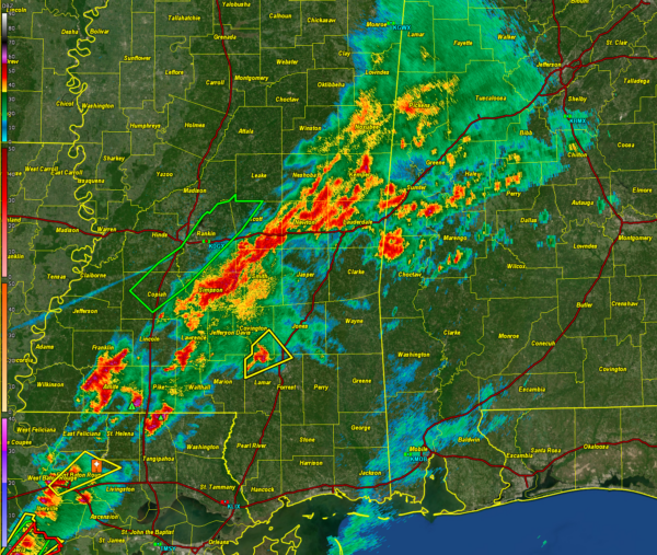
Here is the Jackson radar:
Meanwhile, a severe thunderstorm warning is currently in effect for portions of Lamar, Covington, Forrest, and Jones counties in south-central Mississippi. This system is advancing towards I-59 between Ellisville and Hattiesburg, likely to pass south of Laurel.
A tornado watch continues until 1 a.m. for much of central Mississippi and southeastern Louisiana. we will have to watch these discrete cells over southeastern Mississippi as they move into West central Alabama after midnight. There is some potential for severe weather including hail and damaging winds, but the tornado threat appears low.
Showers and storms will continue across the northern and central part of the state through much of the day tomorrow. Some of those storms could be strong, but significant severe weather is not likely.
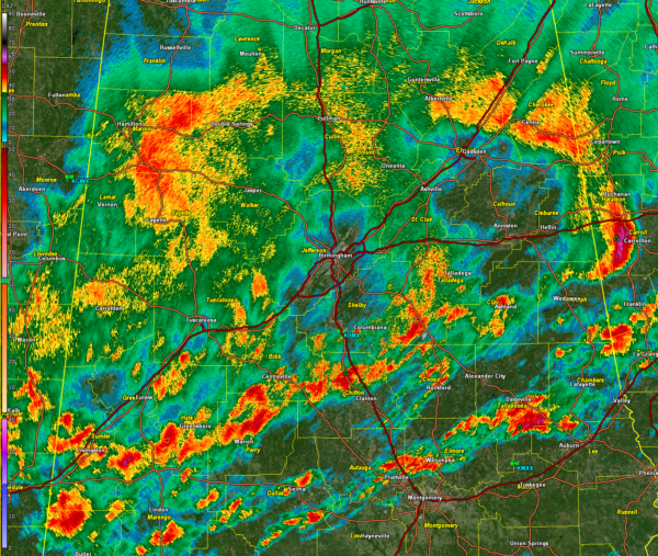
Additional heavy rain is in progress across Central Alabama at this hour. Here is the Birmingham radar:
Expect this heavy rain to persist overnight, potentially bringing an additional one to two inches of rainfall across Alabama. This could exacerbate flooding in creeks, streams, and areas already saturated by heavy rainfall, including urban and poor drainage locations.
Flash flood watches continue for a large part of Central Alabama through 6 p.m. Monday.
Please monitor water levels in your vicinity and ensure you have a reliable method to receive flash flood warnings throughout the night.
We’ll make sure to keep an eye out for timely updates as the situation continues to unfold.
Category: Alabama's Weather, ALL POSTS, Severe Weather


