Dry Through Tomorrow; Cold, Wet On Sunday
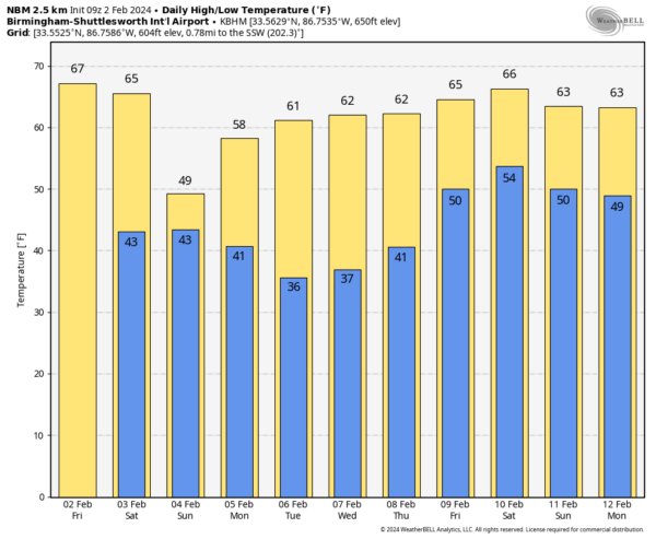
MILD AFTERNOONS: With a partly to mostly sunny sky, we project a high in the 65-75 degree range across Alabama this afternoon. Expect similar temperatures tomorrow, and the day will be dry although clouds will increase by afternoon.
Rain will begin to push into the state tomorrow night, and Sunday will be a wet and much colder day with occasional rain. Temperatures will hold in the 40s all day over the northern third of the state, with 50s to the south. There could be a rumble of thunder near the Gulf Coast, but the air will be stable and there is no risk of severe thunderstorms. Rain ends early in the day Monday… amounts will be 1/2 to 1 inch over North Alabama, with 1 to 1.5 inches over the southern half of the state.
REST OF NEXT WEEK: The weather will be rain-free Tuesday through Thursday with highs returning to the 60s. Then, a weather system will bring the next chance of rain on Friday. Still no sign of any bitterly cold Arctic air for the Deep South for the next 7-10 days… See the video briefing for maps, graphics, and more details.
ON THIS DATE IN 1952: An area of low pressure moved out of the Gulf of Mexico and across southern Florida during the evening and late-night hours on February 2, 1952. It produced 60 mph winds and two to four inches of rain on February 2 and 3. The low pressure remains the only tropical storm to impact the United States in February.
ON THIS DATE IN 1996: An Arctic outbreak that lasted from late January through early February produced nearly 400 hundred record lows, 15 all-time low readings, and over 50 new record lows. Four states recorded their all-time record low temperatures, including Tower, Minnesota, on this date with a reading of 60 degrees below zero, canceling Tower’s annual Icebox Days festival because it is too cold.
North Alabama was under a blanket of snow and ice on February 2, 1996.
Look for the next video briefing here by 3:00 this afternoon… enjoy the day!
Category: Alabama's Weather, ALL POSTS, Weather Xtreme Videos


