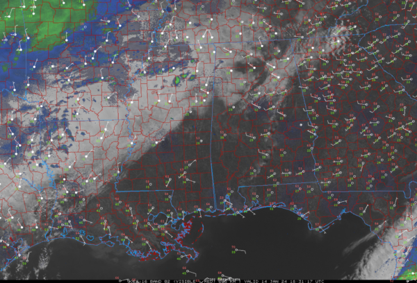
Precipitation Breaking out in Northern Mississippi
Regional radars show precipitation beginning to break out now over Northern Mississippi. A lot of it may not be reaching the ground just yet,b ut it won’t take long for the atmosphere to moisten. There was recently an mPING report of freezing drizzle at Clarksdale in western Mississippi.
Temperatures are in the middle 20s to lower 30s in northern Mississippi at this hour.
The cold front extends from Gadsden to Alabaster to Demopolis across Alabama, but the mass of Arctic air is north of a line from Columbus MS to Haleyville in Alabama to Elkmont TN. This Arctic line may sink a little further south, but it is not expected to move appreciably southward until tomorrow afternoon.
A wintry mix will begin over Alabama’s Northwest counties, falling mostly as snow, around 4-5 pm over Colbert, Lauderdale, and Franklin counties perhaps into Marion and Winston. The snow will overspread the Tennessee Valley by 10 p.m. with accumulations beginning overnight. Temperatures will be below freezing by 7-8 p.m. over the entire Tennessee valley, which will allow the accumulations.
Freezing rain will start between 6-7 p.m. over the rest of Marion and Winston Counties.
The NWS Huntsville may have to extend the Winter Storm Warning and their Winter Weather Advisory to begin earlier than the currrent slated time of midnight. They may have to move it up to 6 p.m. this evening.
There may be some break in the precip early Monday morning, but it will be on the increase again by late morning into the afternoon.
Further south, additional freezing rain will break out over WEst Central Alabama between 3-4 p.m. tomorrow, increasing in coverage through the evening hours.
The precipitation should be out of East Alabama by 5 a.m. Tuesday, but a glaze of ice will cover potentially a widespread area of Central Alabama north of a line from Demopolis to Clanton to Roanoke.
I will have frequent updates here on the blog.
Category: Alabama's Weather, ALL POSTS, Severe Weather


