Dry Tomorrow/Thursday; Severe Storms Possible Friday
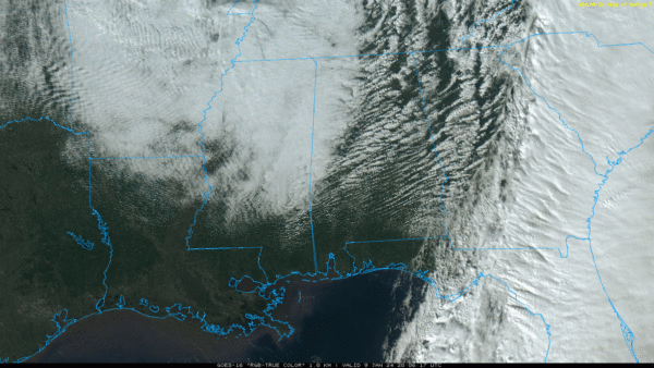
RADAR CHECK: Most of Alabama is dry at mid-afternoon; the sky is sunny over much of South Alabama, but more clouds are moving into the northwest counties of the state ahead of a disturbance rotating around a deep upper trough to the north. That feature will have potential to squeeze out some light rain, or even snow flurries or snow showers over the northern third of Alabama late this afternoon and early tonight. If we do see any snow, temperatures will be above freezing and we expect no impact. Where heavier snow showers develop across higher terrain some light accumulation is possible on grassy areas.
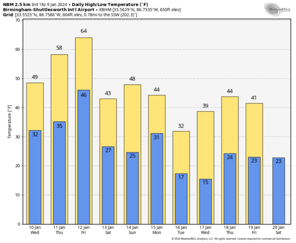
TOMORROW/THURSDAY: Dry weather is the story on these two days. Highs tomorrow will be in the 40s over North Alabama, with 50s to the south. Thursday will be warmer with highs in the 50s and 60s.
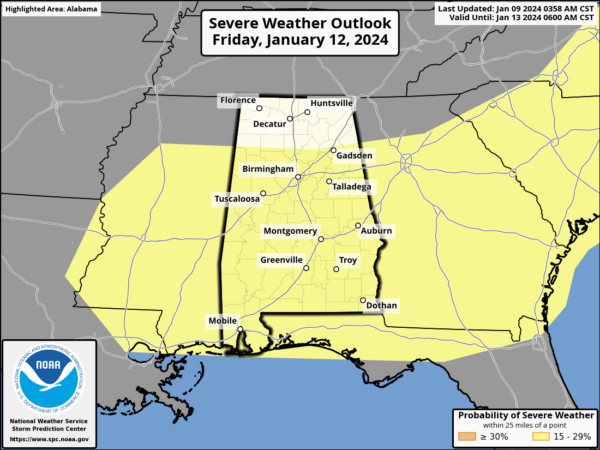
FRIDAY: Yet another dynamic system will bring more wind and rain to Alabama. SPC has the southern 2/3 of the state in a severe weather risk; it looks like unstable air will extend farther north into the state for this event.
This looks like a daytime event Friday; storms will be capable of producing strong winds and a few tornadoes. Gradient winds will also be strong Friday, much like the event last night. Storms will be moving quickly, and we expect rain amounts around one inch.
THE ALABAMA WEEKEND: Saturday will be windy and colder with highs mostly in the 40s. Temperatures should be well below freezing by Sunday morning. The weekend will be dry.
NEXT WEEK: Global models are suggesting a weather system has potential to bring some “winter mischief” to parts of North Alabama Monday or Monday night (freezing rain or snow). But understand this will change multiple times over the next few days, and confidence in any specific outcome is very low. It could be just a cold rain. However, confidence is high the coldest air so far this winter season will roll into Alabama by Tuesday and Wednesday. This could get many places in the 10-15 degree range over the northern half of the state. See the video briefing for maps, graphics, and more details.
ON THIS DATE IN 2006: With cold air sweeping in from the Himalayas, New Delhi reported frost for the first time in 70 years with a low temperature of 0.2°C (32.3°F). The cold prompted officials to order all schools to close for three days.
Look for the next video briefing here by 6:00 a.m. tomorrow…
Category: Alabama's Weather, ALL POSTS, Weather Xtreme Videos


