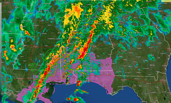
2:15 a.m. Update
At this hour, here is the latest…
…Two lines of thunderstorms over Central and South Alabama at this hour. Over the Central [art of the state, just heavy rain, gusty winds. Just not enough instability for severe weather.
…Further south, the rear line is more intense over southeastern Mississippi and Louisiana. Severe thunderstorm warnings are lined up from Perry, Stone, Forrest, and Pearl River counties in Mississippi, and Orleans, LaFourche, and Terrebone parishes in Mississippi.
There is a severe thunderstorm warning for northern portions of the City of mobile, including areas around Satsuma and Saraland.
Tornado watch continues until 7 a.m. CST for parts of South Alabama, southeastern Louisiana, southern Mississippi, and Northwest Florida. Storms are lined up over the northern Gulf in a zone of high instability and shear. Those storms will be coming ashore along the Florida Panhandle during the next few hours.
Winds have diminished over North and Central Alabama, but will increase again later this morning. Wind advisories continue in effect until Tuesday evening.
Category: Alabama's Weather, ALL POSTS, Severe Weather


