Brighter/Warmer Day Tomorrow
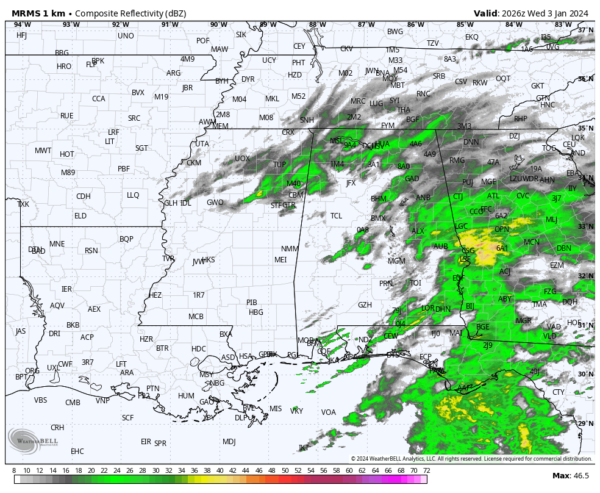
RADAR CHECK: Light rain continues over parts of East and Southeast Alabama this afternoon… the rest of the state is under a mostly cloudy sky with temperatures in the 40s. We note some clearing around Mobile, where they have reached the low 50s. Lingering rain will end early tonight, followed by a clearing sky.
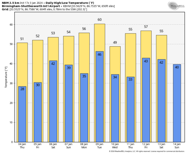
Tomorrow will be a dry day with ample sunshine along with a high in the 50s.
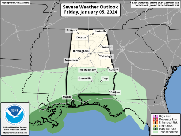
FRIDAY AND THE WEEKEND: Clouds return Friday, and rain will begin Friday afternoon with the next weather system across Southwest Alabama. A good soaking is likely statewide Friday night, with potential for over one inch of rain. We note SPC has defined a “marginal risk” of severe thunderstorms for the Gulf Coast Friday night, where storms could produce strong gusty winds. A brief, isolated tornado can’t be ruled out near the coast.
Rain will end early Saturday morning… for most of the state it now looks like the bulk of the rain will come from about 6:00 p.m. Friday through 6:00 a.m. Saturday. The sky will begin to clear Saturday afternoon as dry air arrives, and Sunday will be rain-free with a partly to mostly sunny sky. Highs will be in the 50s over the weekend.
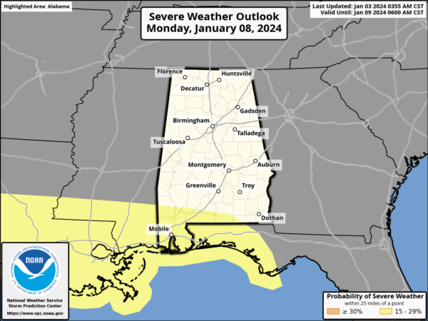
NEXT WEEK: Another dynamic weather system will bring more rain to Alabama Monday afternoon through Tuesday. This one has potential to produce 1-2 inches of rain, and SPC has defined a risk of severe storms again near the Gulf Coast.
Dry weather is likely Wednesday through Friday with seasonal temperatures; highs mostly in the 50s with lows mostly in the 30s. See the video briefing for maps, graphics, and more details.
ON THIS DATE IN 1949: During the late afternoon hours, an estimated F4 tornado destroyed Warren, Arkansas. The tornado killed 55 people and injured more than 250 others. The destruction of the Bradley mill displaced 1,000 employees.
ON THIS DATE IN 2018: The first time in 28 years, light snowfalls in Tallahassee, Florida. The NWS Office in Tallahassee measured 0.1″ of snow/sleet at 8:30a ET.
ON THIS DATE IN 2023: A total of 14 tornadoes touched down across Alabama, including an EF-2 over northeast Elmore County that crossed Lake Jordan.
Look for the next video briefing here by 6:00 a.m. tomorrow…
Category: Alabama's Weather, ALL POSTS, Weather Xtreme Videos


