Midday Nowcast: A Cold and Wet Wednesday
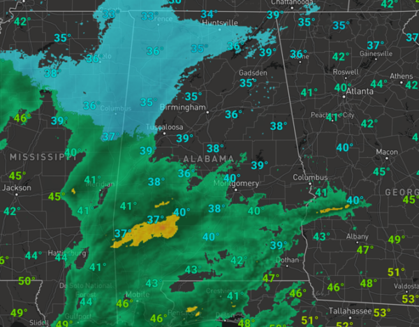
A weak surface low is moving through the northern Gulf of Mexico and has spread clouds and rain into Alabama today. In fact, there is likely a little bit of sleet mixing in with the rain over portions over North/Central Alabama, but with surface temperatures above freezing, there will be no impacts. The most widespread rain is over the southern 2/3 of the state, but rain is possible statewide as the system moves through the state. Rain amounts will be light, mostly under 1/2 inch. It is a cold rain with temperatures struggling to climb out of the 30s into the 40s. The rain will end later this evening, and tonight will be another cold night with lows in the mid and upper 20s.
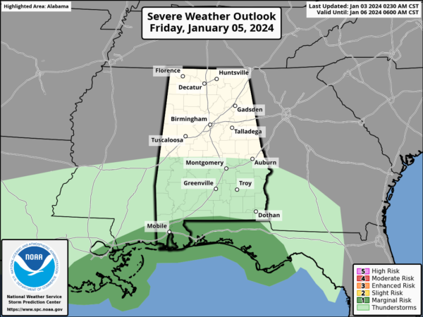
REST OF WEEK: Dry air returns to Alabama tomorrow with a mainly sunny sky, highs will be in the low to mid 50s. Highs Friday will be in the low 50s again, but clouds will be increasing through the day as our next weather system develops in the Gulf. By the afternoon, rain will begin to spread into the state as this low tracks through far South Alabama. We note SPC has defined a “marginal risk” of severe thunderstorms for the Gulf Coast Friday night, where storms could produce strong gusty winds. A brief, isolated tornado can’t be ruled out near the coast.
For the rest of the state, it will be plain rain, which could be heavy at times. Rain amounts Friday night and into early Saturday morning will be around one inch for much of Alabama.
WEEKEND WEATHER: The rain ends during the morning hours and by Saturday afternoon the sky will be clearing as dry air returns to the state. Sunday will be dry with a mostly sunny sky and highs will be in the 50s both days this weekend.
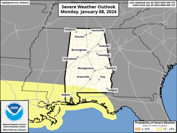
NEXT WEEK: Another dynamic system will bring rain and storms to Alabama Monday night into Tuesday. This system also has potential for 1-2 inches of rain, and strong storms could be an issue for the southern counties of the state. The SPC maintains a risk of severe storms near the Interstate 10 corridor on their day 6 convective outlook.
We will continue to monitor trends with this system, as the severe weather threat could move farther north in future forecasts. For the rest of next week, it will be dry with highs in the 50s and lows in the 30s. The next rain maker looks to arrive over the weekend (January 13th-14th).
BEACH FORECAST CENTER: Get the latest weather and rip current forecasts for the beaches from Fort Morgan to Panama City on our Beach Forecast Center page. There, you can select the forecast of the region that you are interested in visiting.
WORLD TEMPERATURE EXTREMES: Over the last 24 hours, the highest observation outside the U.S. was 115.2F at Siteki, Eswatini. The lowest observation was -65.9F at Yurty, Russia.
CONTIGUOUS TEMPERATURE EXTREMES: Over the last 24 hours, the highest observation was 79F at Brownsville, TX. The lowest observation was -18F at Peter Sinks, UT.
Category: Alabama's Weather, ALL POSTS


