One More Dry Day Before Rain Returns
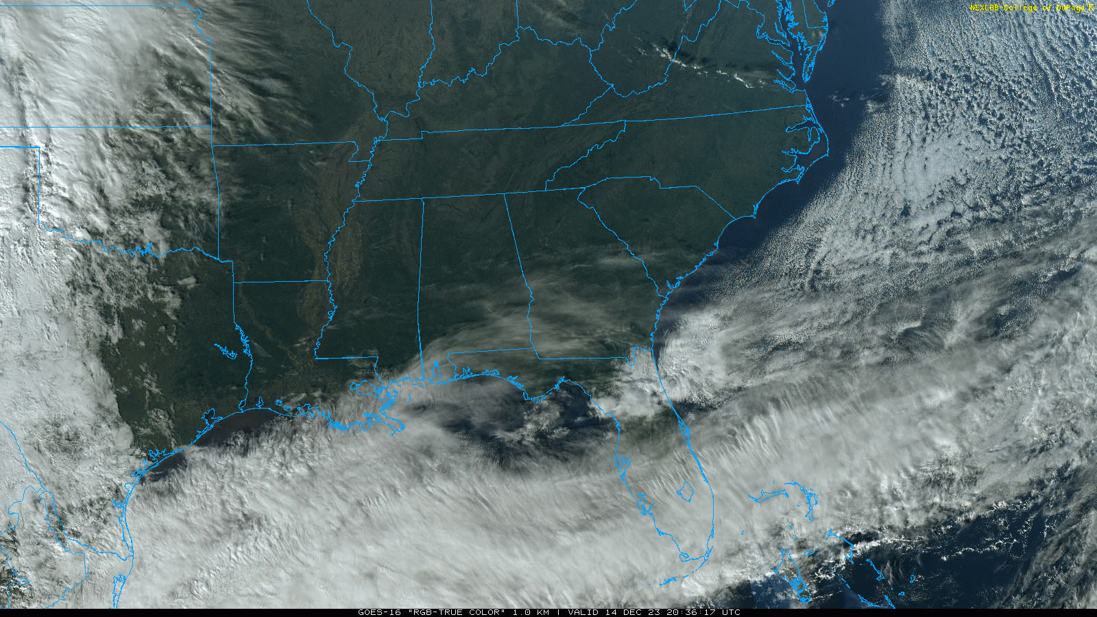
THIS AFTERNOON: The sky is sunny across Alabama this afternoon with temperatures in the 60s… tonight will be fair with a low between 35 and 45 degrees for most places.
RAIN RETURNS: A surface low will form in the northern Gulf of Mexico tomorrow night, and will spread rain into Alabama over the weekend. Models are more aggressive with moisture return in recent runs, and rain now seems likely for most of the state. The rain will begin Saturday over the southern and western counties, and will spread to the north and east Saturday night and early Sunday. There is no risk of severe thunderstorms, and probably very little thunder. Rain amounts will be heavier over the eastern counties of Alabama, where 1-2 inches are likely. The southeast corner of the state around Dothan could see over two inches. The western counties will see amounts generally around 1/2 inch.
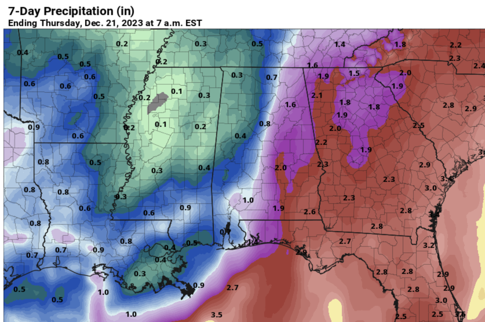
Highs over the weekend will be in the 55-60 degree range with clouds and occasional rain. The latest guidance suggests the rain will end Sunday morning.
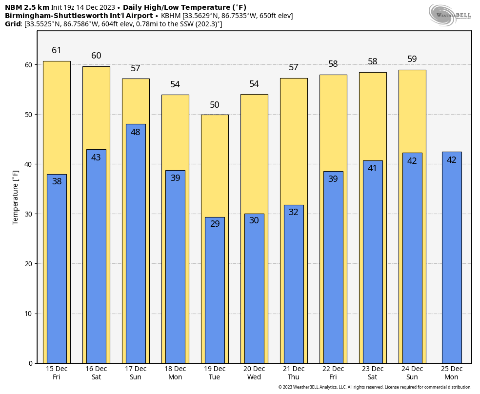
NEXT WEEK: Dry air returns Sunday night, and next week looks rain-free with sunny cool days and fair, chilly nights. Highs will be mostly in the mid to upper 50s, with lows in the 30s. A freeze is likely over the northern half of the state Tuesday, Wednesday, and Thursday mornings.
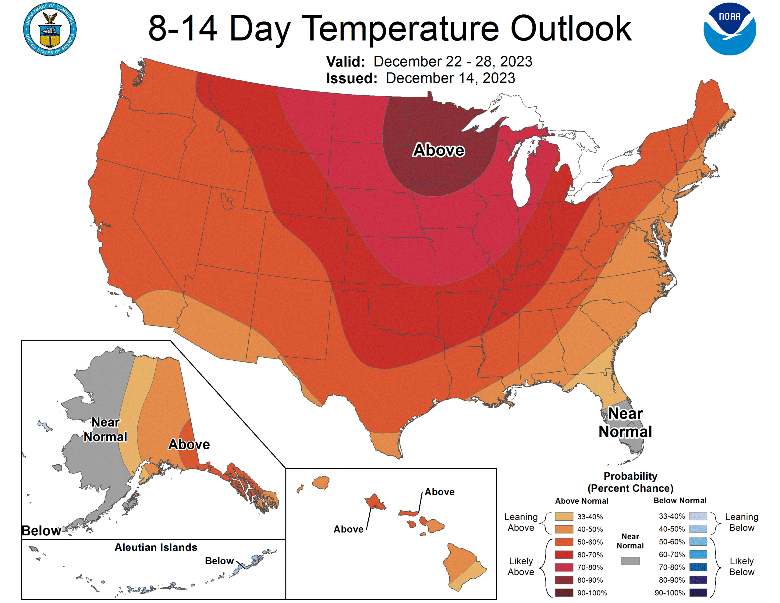
CHRISTMAS WEEK: Long range guidance continues to suggest relatively mild Pacific air will cover much of the contiguous U.S. with temperatures a little above average for late December. See the video briefing for maps, graphics, and more details.
ON THIS DATE IN 1952: Trace of snow or sleet at or near Pensacola, Crestview, DeFuniak Springs, Quincy, Carrabelle, Tallahassee, St. Marks, Monticello, Madison, Mayo, Live Oak, Lake City, Glen St. Mary, and Hilliard in Florida. Frozen precipitation occurred before noon at most points, but happened in the afternoon at Mayo and Lake City and near Hilliard. Temperatures were above freezing and snow or sleet melted as it fell.
ON THIS DATE IN 1997: Parts of West-Central Alabama saw significant snowfall of 4 to 8 inches thanks to a deep, cold core upper low passing over the region. To the west in Mississippi, this was one of the heavier snowfalls to occur since 1929. The weight of the snow caused limbs of trees to break, which knocked down power lines. Heavier snow in Alabama fell in places like Demopolis and Livingston.
Look for the next video briefing here by 6:00 a.m. tomorrow…
Category: Alabama's Weather, ALL POSTS, Weather Xtreme Videos
About the Author (Author Profile)
James Spann is one of the most recognized and trusted television meteorologists in the industry. He holds the AMS CCM designation and television seals from the AMS and NWA. He is a past winner of the Broadcast Meteorologist of the Year from both professional organizations.Subscribe
If you enjoyed this article, subscribe to receive more just like it.


