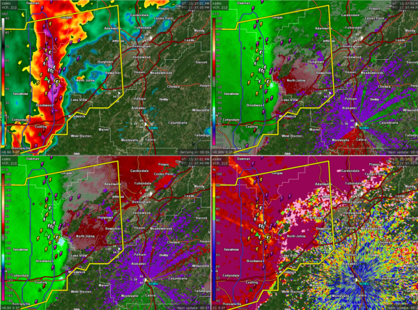
Strong Winds Moving Towards Jefferson and Shelby Counties
Two areas of strong winds on a bow echo that is moving through into western Jefferson, northern Bibb, and western Shelby Counties.
One is near Vance along I-59. This surge is going to move east northeast into northern Bibb county near Woodstock and Caffee Junction then into northwestern Shelby County near Helena, Pelham, and Alabaster. This potential damaging winds will reach McCalla around midnight, Hoover around before 12:15 and Helena around 12:10.
Another surge is north of Brookwood. There is a mesocyclone there that is reaching the lowest tilt on the radar indicating we could see a tornado develop. This surge i smoving into western Jefferson County near North Johns then Hueytown, Fairfield, Bessemer, Homewood, and Vestavia Hills. Hueytown about 11:57 pm., Pleasant Grove by 12:02, Homewood 12:13 a.m., Mountain Brook 12:19, and Leeds by 12:33 a.m.
Winds could gust to 50-70 mph as the line of storms moves across the area. Be in a safe place as the line approaches you.
Other very strong storms are in Greene moving into Hale County. They will move into Bibb and Perry Counties.
The NWS in Birmingham and lots of meteorologists are watching the storm carefully, especially the rotation near North Johns.
Category: Alabama's Weather, ALL POSTS, Severe Weather


