A Quick Mid-Evening Check On Our Weather Situation
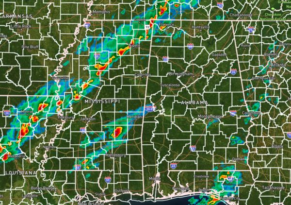
Radar as of 5:50 pm shows a line of strong to severe storms moving through the northwestern parts of the state and through the northern half of Mississippi. The good news is that this part of the line of storms have only produced strong winds and no tornadoes, but the news is not so good up in Tennessee where at least one large tornado moved through Hendersonville and Gallatin.
There is another batch of rain and storms that have developed in front of the line down in the southeastern part of Mississippi, and only one severe thunderstorm warning is in effect on that cluster.
For North and Central Alabama, a severe thunderstorm warning is in effect until 6:15 pm for portions of Colbert and Lauderdale counties. This is the second time these counties have been under a warning this evening.
While the threat of tornadoes, damaging winds, and large hail will be possible through the evening, the storms along the front will increase, and it will become more linear with damaging winds becoming the main threat with a brief spin-up tornado possible.
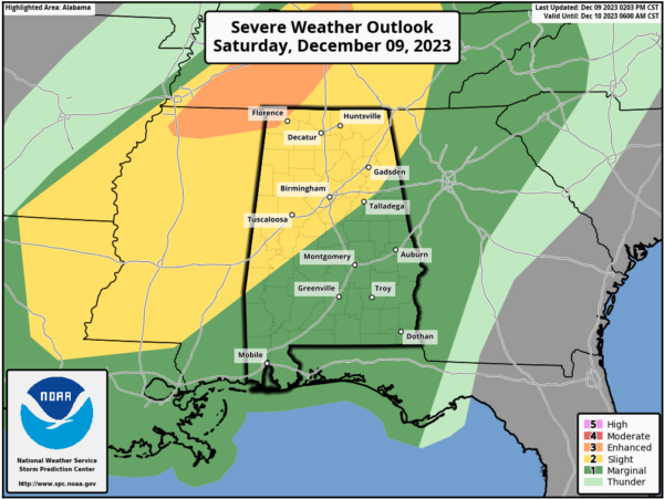
An Enhanced Risk continues for the extreme northwest corner of the state, while a Slight Risk continues east and south to a line from Anniston to Jemison to Linden. The rest of the state is under a Marginal Risk for severe storms. The main window for the threat of strong to severe storms will be from now through 8 am across the area from northwest to southeast.
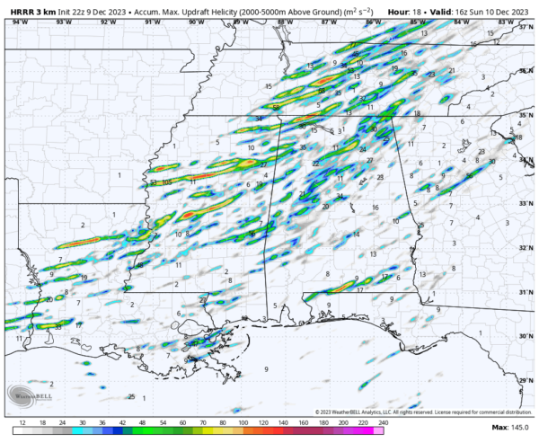
Updraft helicity tracks off of the latest HRRR shows that rotating updrafts will be possible over the northwestern half of the state through the event with a little action down over the FL/AL state line. That means that the potential for strong storms with tornadoes will be there.
Please continue to stay weather aware through the rest of tonight, and say a quick prayer for those affected by tonight’s tornadoes in Tennessee.
Category: Alabama's Weather, ALL POSTS, Severe Weather


