An Update on the Severe Weather Situation at 3:30 p.m.: Tornado Watch for North Alabama
There is a threat for severe weather this afternoon through the overnight for North and Central Alabama. The highest threat includes the I-59 Corridor counties back to the northwest, but a lesser risk exists through the overnight as well for the remainder of Central Alabama. All modes of severe weather are possible, including damaging winds, large hail, and tornadoes.
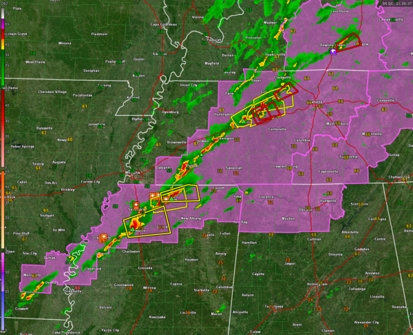
Strong to severe storms continue ahead of a cold front this afternoon from near Bowling Green KY to near Waverly TN (west of Nashville) to south of Jackson TN to near Holly Springs MS to just east of Clarkdale MS and back into southeastern Arkansas.
The storms in northern Mississippi near Batesville and Holly Springs are severe at this time. Tennis ball sized hail was reported in Coldwater in Tate County, MS at 2:30 p.m. There have been several reports of large hail with the storm near Holly Springs MS.
The storms north of I-40 to the west of Nashville are severe. There are a couple of severe thunderstorm warnings and a tornado warning with those cells. The most dangerous storm is passing near and south of Waverly TN. These storms will affect the Nashville area in the next 75 minutes around 4:30 p.m. New tornado warning for Dickson County, TN.
There were several tornadoes reported from a single supercell that moved across Stewart and Montgomery Counties in Tennessee into Todd County, Kentucky. Tornado damage was reported near Indian Mound, TN, near Woodlawn TN, and across northern portions of Clarksville, TN, as well as near Guthrie, KY. Injuries have been reported but no reports of fatalities at this time. This storm moved into Bowling Green KY but was weakening at the time and it is now northeast of the city.
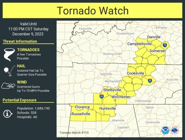
A tornado watch was just issued for 7 counties in North Alabama including Colbert, Lauderdale, Franklin, Lawrence, Limestone, Madison and Morgan. It goes until 11 p.m.
The SPC says another tornado watch is likely for much of Central Mississippi, southeastern Arkansas, and northeastern Louisiana in the next hour. The line of storms is expected to develop southwestward into this region and sweep southeastward. But storm could form ahead of the line and become discrete supercells which can produce a higher tornado threat. This activity will push into West Central Alabama as well by 6-7 p.m. The threat for severe weather will continue through the evening and into the overnight.
Scott Martin and I will be covering the severe weather threat for Alabama throughout the afternoon, evening, and overnight.
Category: Alabama's Weather, ALL POSTS, Severe Weather


