Mesoscale Discussion: Tornado Watch Likely Soon, Could Include Parts of Northwest Alabama
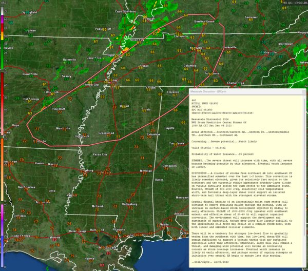
We are getting started early this morning on today’s and tonight’s severe weather threat. The SPC has just notified NWS offices and weather partners that a watch is likely by early afternoon or sooner if the developing storms over Arkansas starts to become stronger.
As daytime heating works on a moist airmass, instability levels will be approaching 1,000-2,000 joules/kg with effective shear of 50-60 knots, which is a pretty robust combination for severe weather.
The alignment of the shear may lend itself to a line of convection with embedded supercells. There will also be sufficient low level shear for tornado formation. Large hail and damaging winds will be a threat as well.
Category: Alabama's Weather, ALL POSTS, Severe Weather


