Strong Storms Move In Tonight; Much Cooler Air Invades After That
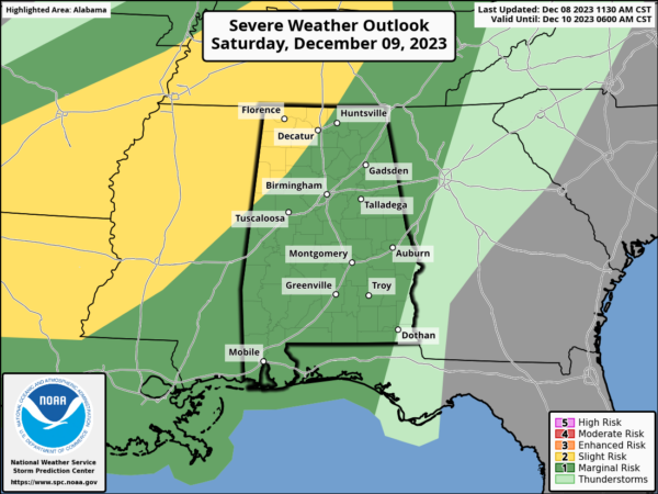
A cold front will approach the area today that will bring rain and a few storms during the daylight hours, but as the front begins to move in and across Central Alabama tonight and into the morning hours on Sunday, a few strong to severe storms will be possible. The main window will be from as early as 6pm in the northwest, and will continue until around 10am in the southeast. The SPC has the northwest corner of the state in a Slight Risk, while nearly the rest of the state is in a Marginal Risk. Isolated damaging winds or a brief tornado may be possible, but the good news is that the better dynamics will be far displaced from us. Highs in the upper 60s to the mid 70s.
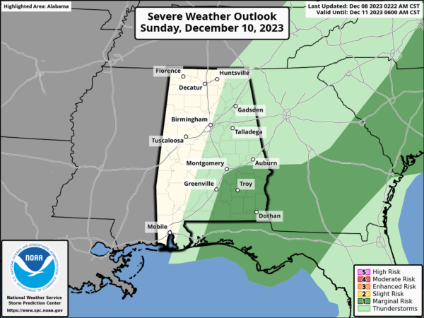
The system will continue to move through the east and southeastern parts of the area on Sunday morning, and a Marginal risk is up for those southeastern locations. Rain and storms will come to an end area wide during the evening and much cooler air will move in behind it. Highs will range from the mid 40s to the lower 60s.
Much calmer weather can be expected for the work week ahead. Monday will be a bright and sunny day, but it will be cool with highs only in the upper 40s to the mid 50s.
Tuesday will be a little bit warmer with highs in the mid to upper 50s under sunny skies.
We’ll have some clouds block out the sun at times on Wednesday, but we’ll stay dry and cool. Highs in the mid 50s to the lower 60s.
About the same story on Thursday with plenty of sun and a few clouds. Highs in the upper 50s to the lower 60s.
And at the end of the forecast period on Friday… Mostly sunny skies and remaining cool as highs will be in the mid 50s to the lower 60s.
Category: Alabama's Weather, ALL POSTS, Severe Weather, Weather Xtreme Videos


