Midday Nowcast: Increasing Clouds Today; Storms Return Tomorrow Night
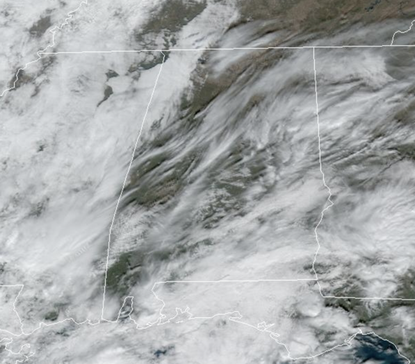
Our next storm system is getting its act together to our west and a warming trend has started today. We are seeing more clouds in the Alabama sky today and afternoon temperatures are surging into the 60s for most of Alabama. Most of today will be dry, but a few showers are certainly possible, especially across southern sections of the state.
STORMY SATURDAY NIGHT: Tomorrow, the sky will feature more clouds than sun, and temperatures reach the low 70s in many places by afternoon. Some showers and storms are possible during the day, but most of the day will be dry. Our winds will be increasing through the day, and by tomorrow afternoon and evening, gradient winds (not related to thunderstorms) out of the south will average 15-25 mph, with possible gusts to 30 mph before the line of storms arrives and moves through the state.
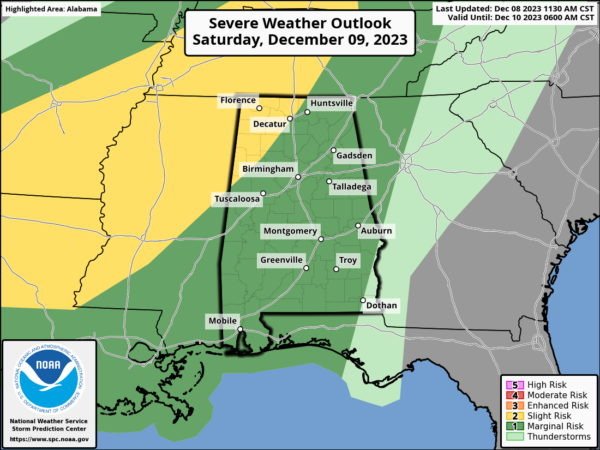
Tomorrow night, the dynamic storm system to our west, will push widespread rain and storms into Alabama tomorrow night. The SPC has defined a “slight risk” (level 2/5) of severe thunderstorms for the northwest counties of the state, along and northwest of a line from Fayette to Decatur, and a “marginal risk” (level 1/5) for most of the rest of Alabama.
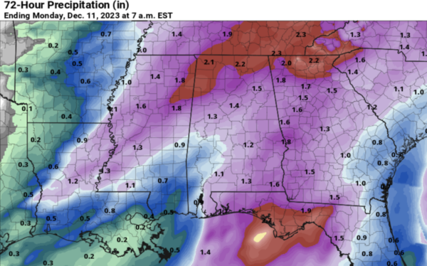
A positive tilt to the upper trough, limited surface based instability, and marginal SRH (storm relative helicity) values should help to keep the overall severe weather threat limited. The main risk for strong to severe thunderstorms across Alabama will come from around 9PM tomorrow night through 6AM Sunday morning. The primary threat will come from strong, gusty thunderstorm winds. A brief, isolated tornado can’t be ruled out, especially in the “slight risk” across Northwest Alabama, but it isn’t likely due to the lack of shear. Rain amounts will be in the 1-2 inch range for much of the state.
SUNDAY: As the front moves through the state, the rain will end from northwest to southeast Sunday morning. Much colder air rolls into the state during the day Sunday. It will be a cold and blustery day with temperatures in the 40s; add in the brisk northwest wind, ands it will feel much colder. The sky should be to clear by mid to late afternoon.
NEXT WEEK: Below average temperatures highlight the forecast for much of next week as a cooler and dry air mass settles into the state. Highs will be in the 50s, while lows will be in the 30s. Most of next week looks day, but towards the end of the week, our next rainmaker looks to arrive.
BEACH FORECAST CENTER: Get the latest weather and rip current forecasts for the beaches from Fort Morgan to Panama City on our Beach Forecast Center page. There, you can select the forecast of the region that you are interested in visiting.
WORLD TEMPERATURE EXTREMES: Over the last 24 hours, the highest observation outside the U.S. was 114.4F at Oodnadatta Airport, Australia. The lowest observation was -62.3F Iema, Russia.
CONTIGUOUS TEMPERATURE EXTREMES: Over the last 24 hours, the highest observation was 81F at Fort Stockton, Wink, and Pecos, TX. The lowest observation was -6F at Chesuncook, ME.
Category: Alabama's Weather, ALL POSTS


