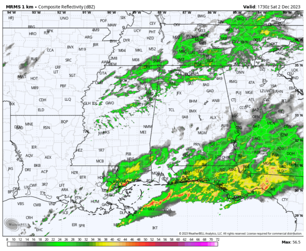
Some Showers Remain at Midday; More Possible Through the Day
The coverage of showers have diminished somewhat from this morning as storms have formed over the Gulf Coast and is robbing the rest of the area of the needed moisture for shower and thunderstorm development. We are still expecting a couple more short waves to move across the area this afternoon and evening that will bring an increase in showers once again, but most likely not as heavy as this morning and prior to sunrise. While severe weather is not likely across any part of North and Central Alabama, a strong storm cannot be completely ruled out south of I-85 and US-80.
11 am temperatures were in the lower 60s to the lower 70s across the area thanks to a warm front that moved through the area earlier this morning and with the humid air in place. Tuscaloosa was the warm spot at 71º, while the cool spot was Haleyville at 63º. Birmingham was at 66º with cloudy skies. We are pretty close to our afternoon highs, but a few locations may warm a couple of more degrees.
For tonight, the best coverage of showers and thunder will be over the east and southeastern parts of the area, mainly east of a line from Demopolis to Jacksonville. Rain chances drop as you move west of those areas, with only a few isolated showers possible over the northwestern parts of Central Alabama. Lows will range from the lower 50s to the mid 60s from northwest to southeast.
A cold front will swing through the area on Sunday that will bring a shot of dry and cooler air to the area during the late morning through the afternoon hours. Before that occurs, showers will be possible over the east and southeastern parts of the area during the morning. By mid-afternoon, everyone should be dry with clouds slowly decreasing in coverage. Highs will top out in the mid to upper 60s for most across Central Alabama from northwest to southeast.
The rest of the work week ahead continues to look dry with moderating temperatures for the most part, except for Wednesday as a cold front will move through and highs will be held back into the upper 40s to the upper 50s. Our next major chance for rain has now moved into the area on late next Saturday night and through much of next Sunday. While it is too early to be certain, we may have a few strong storms with this system as the surface low will not be that far away from the area. We’ll keep an eye on it for you.
Category: Alabama's Weather, ALL POSTS


