Midday Nowcast: Sunny Wednesday; Wet Weekend Weather
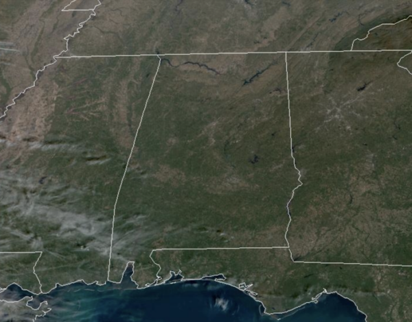
After the frigid start to our Wednesday, we are seeing a gradual warming trend as temperatures surge back into the upper 50s under a mainly sunny sky this afternoon. Tonight will not be as cold, but most locations will still be frosty as lows fall into the upper 20s and lower 30s. Tomorrow will be dry and feature highs in the low 60s, but clouds begin to increase late and rain will return to Alabama late tomorrow night.
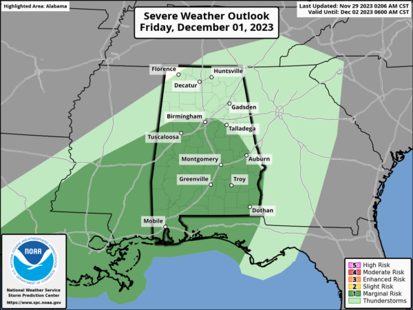
WET IS THE WORD: A welcomed and much needed wet period is ahead for Alabama as multiple rounds of rain and storms should soak the state Friday and through the weekend. For Friday, the SPC has defined a low end “marginal risk” (level 1/5) of severe thunderstorms for the southern 2/3 of Alabama (Birmingham and south); there could be sufficient instability for a few storms with gusty winds during the afternoon and evening hours.
More rain and storms will occur Saturday and Sunday across Alabama. The weekend won’t be a total washout, but it is going to be rather wet with occasional periods of rain and the rain cold be heavy at times. Highs will be in the mid to upper 60s Friday, Saturday, and Sunday. The rain should wind down by Sunday night as drier air begins to filter into the state.
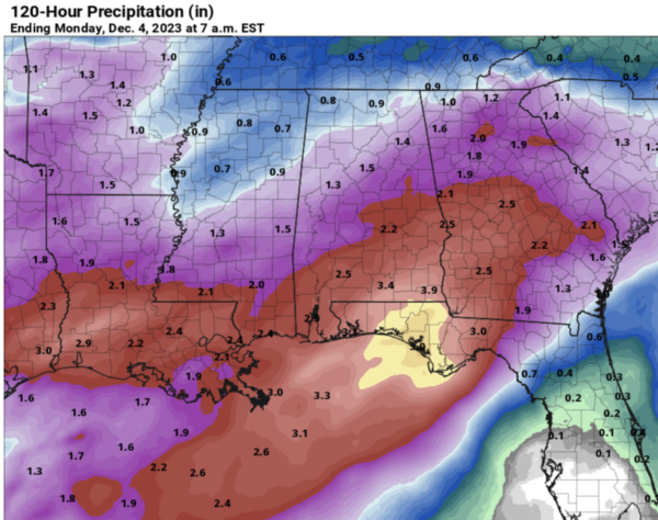
POTENTIAL RAINFALL: South Alabama has the potential for 2-4 inches of rain through Sunday night, with 1-2 inches over the northern half of the state. Very beneficial considering the ongoing drought. It won’t complete wipe out the drought conditions, but it will certainly help, and should go a long ways in replenishing ground water levels, as well as bringing lake and stream levels back up.
FRIDAY NIGHT LIGHTS: For the high school playoff games Friday night, rain is possible statewide, but most likely over the southern counties. Temperatures will be in the 50s.
SEC CHAMPIONSHIP: For fans headed to Saturday’s SEC Championship game in Atlanta (Alabama vs Georgia, 3p CT kickoff)…the game is being played at Mercedes-Benz Stadium under the dome, but outside the stadium rain is likely with temperatures in the low to mid 60s.
NEXT WEEK: For now, much of next week looks relatively quiet and dry. We will stick with highs in the 50s, and lows mainly in the 30s and 40s, but these temperatures could be adjusted downward in future forecasts.
IN THE TROPICS: All is quiet across the Atlantic basin and hurricane season officially ends tomorrow.
BEACH FORECAST CENTER: Get the latest weather and rip current forecasts for the beaches from Fort Morgan to Panama City on our Beach Forecast Center page. There, you can select the forecast of the region that you are interested in visiting.
WORLD TEMPERATURE EXTREMES: Over the last 24 hours, the highest observation outside the U.S. was 108.3F at Tete, Mozambique. The lowest observation was -61.6F Dome A, Antarctica.
CONTIGUOUS TEMPERATURE EXTREMES: Over the last 24 hours, the highest observation was 78F at Phoenix, AZ. The lowest observation was -32F at Peter Sinks, UT.
Category: Alabama's Weather, ALL POSTS


