Midday Nowcast: Increasing Clouds, Watching the Radars to the Southwest
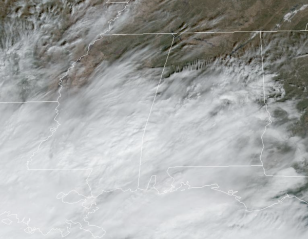
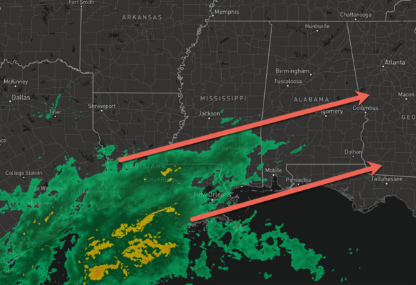
It is mainly dry across Alabama today, but clouds are increasing and we are watching a large mass of rain over parts of Louisiana and Southwest Mississippi. This area of rain will reach the southwest corner of the state later today and tonight. For North/Central Alabama it remains dry with temperatures in the upper 60s and lower 70s today.
RAIN ARRIVES: The mass of rain moves into Alabama tonight and widespread rain is expected over the southern half of the state through the day tomorrow, and statewide Wednesday as a surface low moves along a stalled front near the Gulf Coast. Some lingering light rain is possible in scattered spots Thursday, and a cold front will bring a chance of showers to the state Friday. The southern half of Alabama will see beneficial rain this week, with amounts between 2 and 3 inches for most communities. The central counties will see around one inch, and rain totals over the Tennessee Valley will be light, generally under 1/4?. Again, anything we can get will help, even though we will still need a lot more rain to help alleviate the droughts conditions across the state.
THE ALABAMA WEEKEND: Dry air moves into the Deep South, and the weekend will feature mostly sunny pleasant days and fair cool nights. Highs generally in the 60s, lows mostly in the 40s.
INTO NEXT WEEK: Rain and possibly a few strong thunderstorms will be possible Monday into Tuesday. Still a lot of questions on the timing as the models are not in good agreement.
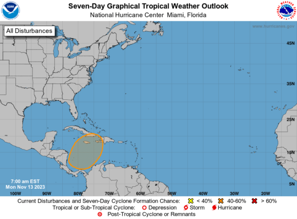
IN THE TROPICS: The Atlantic Basin is quiet right now, but in the Southwestern Caribbean Sea, a broad area of low pressure is expected to form over the southwestern Caribbean Sea in a few days. Gradual development of this system is possible thereafter, and a tropical depression could form late this week while the system begins moving northeastward across the western and central portions of the Caribbean Sea. Formation chance through 7 days…medium…60 percent. Hurricane season ends November 30th and the remaining names on list this year are Vince and Whitney.
BEACH FORECAST CENTER: Get the latest weather and rip current forecasts for the beaches from Fort Morgan to Panama City on our Beach Forecast Center page. There, you can select the forecast of the region that you are interested in visiting.
WORLD TEMPERATURE EXTREMES: Over the last 24 hours, the highest observation outside the U.S. was 114.1F at Villamontes, Bolivia. The lowest observation was -69.2F Dome A, Antarctica.
CONTIGUOUS TEMPERATURE EXTREMES: Over the last 24 hours, the highest observation was 92F at Punta Gorda, FL. The lowest observation was 3F at Angel Fire, NM.
Category: Alabama's Weather, ALL POSTS


