Early Afternoon Forecast Update
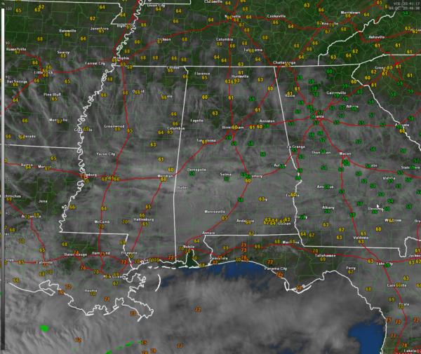
Multilayered clouds continue to shroud much of Alabama this afternoon. Low clouds are still pretty thick and clouds are flowing across in the west to east upper pattern across the South. The exception is the Tennessee Valley, where some sunshine is getting through. This has allowed an unusual temperature difference across the state.
The northern third of Alabama is now in the 60s, with 50s still hanging tough over East Central Alabama. Temperatures will rise another couple of degrees to their afternoon highs. The fact that the coolest readings are over East Central Alabama in the vicinity of the I-85 corridor is no accident. A fairly strong easterly wedge is pumping cool, and moist air into that part of the state.
Clouds will hang tough in many areas through the evening hours, but will begin to thin toward morning, and you will wake up to increasing, although not full sunshine Monday morning. With the clearing skies, temperatures will drop into the 40s over the northern half of the state. South Central Alabama will drop into the lower 50s.
An upper level trough and upper low is positioned over Baja California. This system is weakening and moving out to the northeast. It will spin up a surface low over the western Gulf near Brownsville. Patches of rain are located over South Texas and adjacent areas of Mexico up the Texas Coast to Houston. This rainfall will spread northward and northeastward over the next three days, reaching southwestern Alabama kale Monday night through early Tuesday.
Tomorrow will be partly sunny with highs in the middle and upper 60s, with a few lucky spots hitting 70F. Tuesday mooring lows will be in the 40s and 50s. Through the day Tuesday, most of the rain will stay over South Alabama south of I-20.
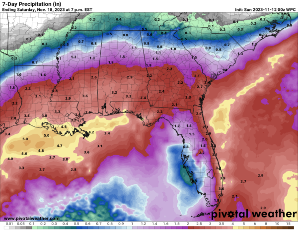
QPF amounts from the Weather Prediction Center are still pretty generous for much of the state. I hope we achieve them for drought sakes! Here are the latest values through next Sunday morning:
Category: Alabama's Weather, ALL POSTS


