Dry Weekend Ahead With Mild Afternoons
**No afternoon video today… I am live on ABC 33/40 at John Carroll High School for Friday Night Rivals (Maplesville at John Carroll on WABM/68)**
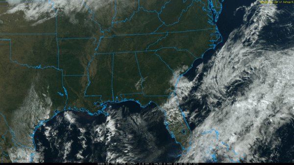
SUNNY, PLEASANT AFTERNOON: The sky is sunny across Alabama again today with temperatures in the 60s and low 70s. Tonight will be clear with a low in the 40s for most places.
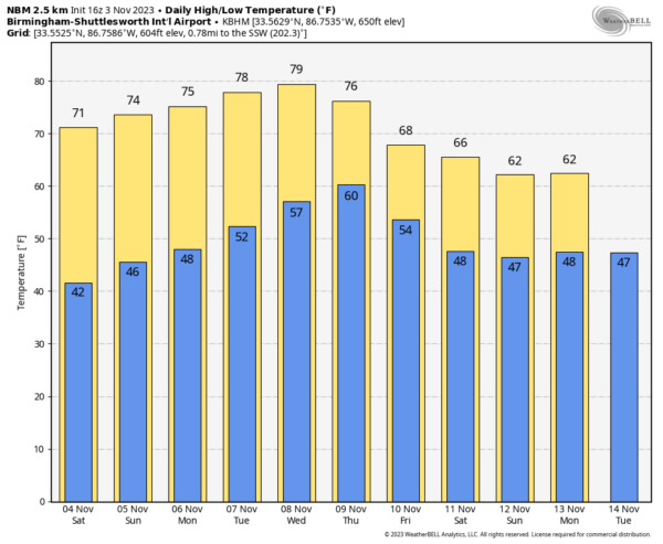
Dry weather continues over the weekend with a warming trend; highs will be in the 70s tomorrow and Sunday with a good supply of sunshine both days.
NEXT WEEK: Still no rain through Wednesday with highs mostly in the 70s. Some spots could touch the 80 degree mark by mid-week as the warming trend continues. Global models suggest a risk of widely scattered showers by Thursday and Friday ahead of a surface front, but the chance of meaningful rain looks low. We continue to see signals of a good rain for the Deep South in the November 14-18 time frame… See the video briefing for maps, graphics, and more details.
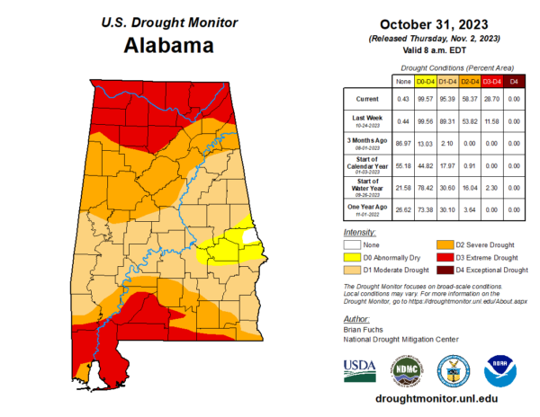
DROUGHT MONITOR: The new drought monitor was released yesterday, and as expected conditions continue to deteriorate. Right now 99.57 percent of Alabama is in a drought. An “extreme drought” is defined for the Tennessee Valley, and also the southwest counties of the state.
FOOTBALL WEATHER: Expect a clear sky for the high school games across Alabama tonight with temperatures falling through the 50s.
Tomorrow, UAB hosts Florida Atlantic at Protective Stadium in downtown Birmingham (2:00p CT kickoff). The sky will be sunny with temperatures in the low 70s.
Auburn travels to Nashville to take on Vanderbilt (3:00p CT kickoff)… the sky will be clear with upper 60s at kickoff, dropping into the low 60s by the final whistle.
And, Alabama will host LSU tomorrow evening at Bryant-Denny Stadium (6:45p CT kickoff)… the sky will be clear with temperatures falling through the 60s. A perfect night for football in Tuscaloosa.
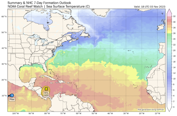
TROPICS: A broad area of low pressure continues to produce a large area of disorganized showers and thunderstorms over the western Caribbean
Sea. Further development of this system appears unlikely before it moves inland over Central America tonight or on Saturday. Regardless of development, this system is expected to bring heavy rains over portions of Central America through the weekend. This rainfall could produce flash flooding, along with mudslides in areas of higher terrain. The chance of development has dropped to 10 percent.
There rest of the Atlantic basin is quiet.
ON THIS DATE IN 1966: An early season snowfall, which started on the 2nd, whitened the ground from Alabama to Michigan. Mobile had their earliest snowflakes on record. Huntsville measured four inches.
ON THIS DATE IN 2001: Hurricane Michelle reached peak intensity on this day as a Category 4 storm. Michelle made landfall on November 4-5, between Playa Larga and Playa Giron, Cuba, as a Category 4 hurricane, the strongest to strike the country since 1952’s Hurricane Fox. The storm caused an estimated $2 billion US dollars in damage to Cuba.
Look for my next video briefing here by 6:00 a.m. Monday… enjoy the weekend!
Category: Alabama's Weather, ALL POSTS


