Sunday Morning Update: A Warm One Today, But Cooler Starting Tomorrow
Everything is on track with this morning’s forecast. Most of Alabama is under mostly sunny skies. The exception is some dense fog over portions of South Alabama. There are a few patches of high clouds over that part of the state as well.
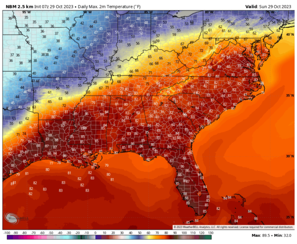
Temperatures are climbing into the lower 60s, heading toward highs mainly in the lower and middle 80s. We are in record territory today. The called for high of 84F at Birmingham is just three degrees shy of the record for the date of 87F set back in 2016.
A snaky front is located just to our northwest. Several low pressure cells are rippling along the boundary, holding back its progress. But a massive upper trough moving through the Great Lakes will sweep it southeastward later today through Monday, pushing it through Alabama by tomorrow afternoon.
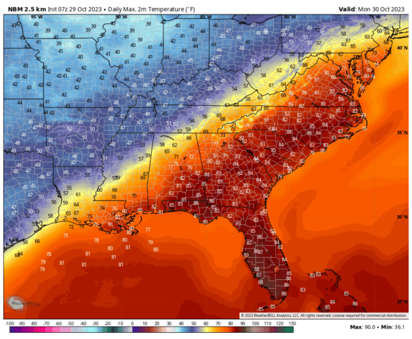
Much colder air will move in behind the front, with lows by Monday morning in the 40s over Northwest Alabama with 60s elsewhere. Monday highs will be very interesting, with highs ranging from 52F at Muscle Shoals, to 62F at BIrmingham, to 75F at Alex City, to 82F at Troy.
Tuesday morning lows will be in the 30s North and Northwest, with 40s elsewhere. Highs on Halloween will be in the middle and upper 50s North and lower 60s Central.
A few spotty showers will reach the northwestern corner of Alabama by sunrise, with a few showers moving across the area during the day and into the evening on Monday. Rain chances will be low and so will amounts. The nearest rain to Alabama this morning is widespread showers over Arkansas.
Much of the northern half of Alabama will experience a freeze Tuesday night. Get ready to protect tender vegetation by then.
Category: Alabama's Weather, ALL POSTS


