An Outstanding Last Saturday of October
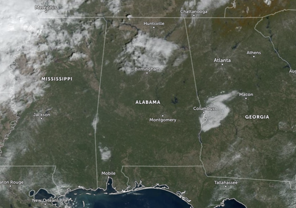
Central Alabama is experiencing plenty of sunshine on this last Saturday of October, except for the northern parts of the area and up into the Tennessee Valley region of the state. We have some stubborn clouds that are deciding to block out the sunshine a little as we are making the run-up to the midday hour. As of 10 am, temperatures across Central Alabama were in the upper 60s to the mid 70s. Afternoon highs will make it up into the lower to mid 80s today. Skies will be mostly clear tonight with overnight lows only falling into the upper 50s to the lower 60s. Weather won’t be much different on Sunday as we’ll have mostly sunny skies and highs in the lower to mid 80s once again.
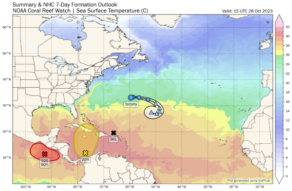
Tropical Storm Tammy is making an eastward turn and is weakening. Winds are currently at 50 mph and is moving to the east at 12 mph, away from Bermuda. This motion is expected to continue today, followed by a turn to the southeast tonight. Early next week, Tammy is forecast to turn southward and eventually southwestward as a remnant low.
Invest 96L formed not that long ago in between the Dominican Republic and the Leeward Islands. Movement is to the northwest at 18 mph, and a tropical depression is likely to form either later today or early on Sunday. For now, it is modeled to remain a depression and eventually curve to the northeast away from the US, but may come close to Bermuda when it starts that turn.
We also have an area of disturbed weather over the southwestern Caribbean Sea that is associated with a broad area of low pressure. Environmental conditions could support some slow development of this system during the next several days while it moves slowly northward.
* Formation chance through 48 hours…low…10 percent.
* Formation chance through 7 days…low…20 percent.
Category: Alabama's Weather, ALL POSTS, Tropical


