
Coldest Air So Far This Season Arrives Early Next Week
**No afternoon video today; I am live at Chelsea High School on ABC 33/40 for tonight’s Friday Night Rivals game, Hewitt-Trussville at Chelsea**
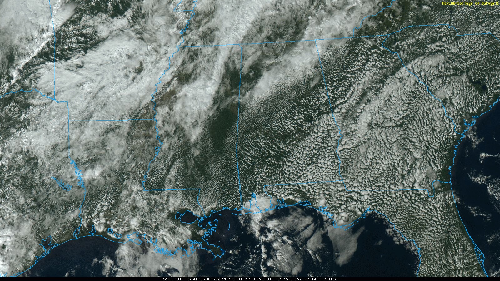
WARM, DRY WEEKEND AHEAD: An upper ridge will continue to keep opportunities for rain west and north of Alabama over the weekend… we expect partly sunny warm days and fair pleasant nights through Sunday. Highs in the 80-85 degree range, with lows mostly in the 60s.
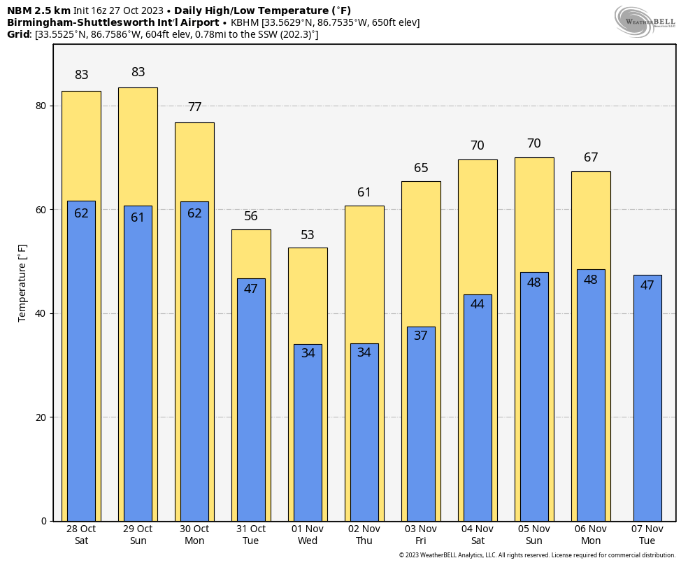
NEXT WEEK: The coldest air so far this season will roll in Alabama. The front will slowly move through the state Monday, setting up a big temperature contrast. By mid to late afternoon, the Tennessee Valley will likely be in the upper 40s, with mid 80s over the southern counties south of the front. New global model data suggests some light rain will be possible both Monday and Tuesday as the cold air arrives. Rain amounts should be under a quarter of an inch, however.
The weather will be dry Wednesday through Friday with very cool days and cold nights. Highs will be in the 50s over the northern half of the state Tuesday and Wednesday, with 60s to the south. Many North Alabama communities will likely see their first freeze of the season by Wednesday and Thursday morning, with lows in the 28-34 degree range. A warming trend begins Thursday afternoon. See the video briefing for maps, graphics, and more details.
FOOTBALL WEATHER: The sky will be clear for the high school games across Alabama tonight with temperatures falling from the mid 70s at kickoff into the upper 60s by the quarter.
For tomorrow’s Magic City Classic in Birmingham (Alabama State vs Alabama A&M, 2:30p CT kickoff at Legion Field)… the sky will be partly to mostly sunny with temperatures in the low to mid 80s. It will be a warm October afternoon.
Auburn hosts Mississippi State (2:30p CT kickoff) at Jordan Hare Stadium… dry and warm weather is the story with temperatures in the 81-84 degree for most of the game. The sky will be partly to mostly sunny.
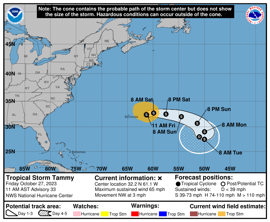
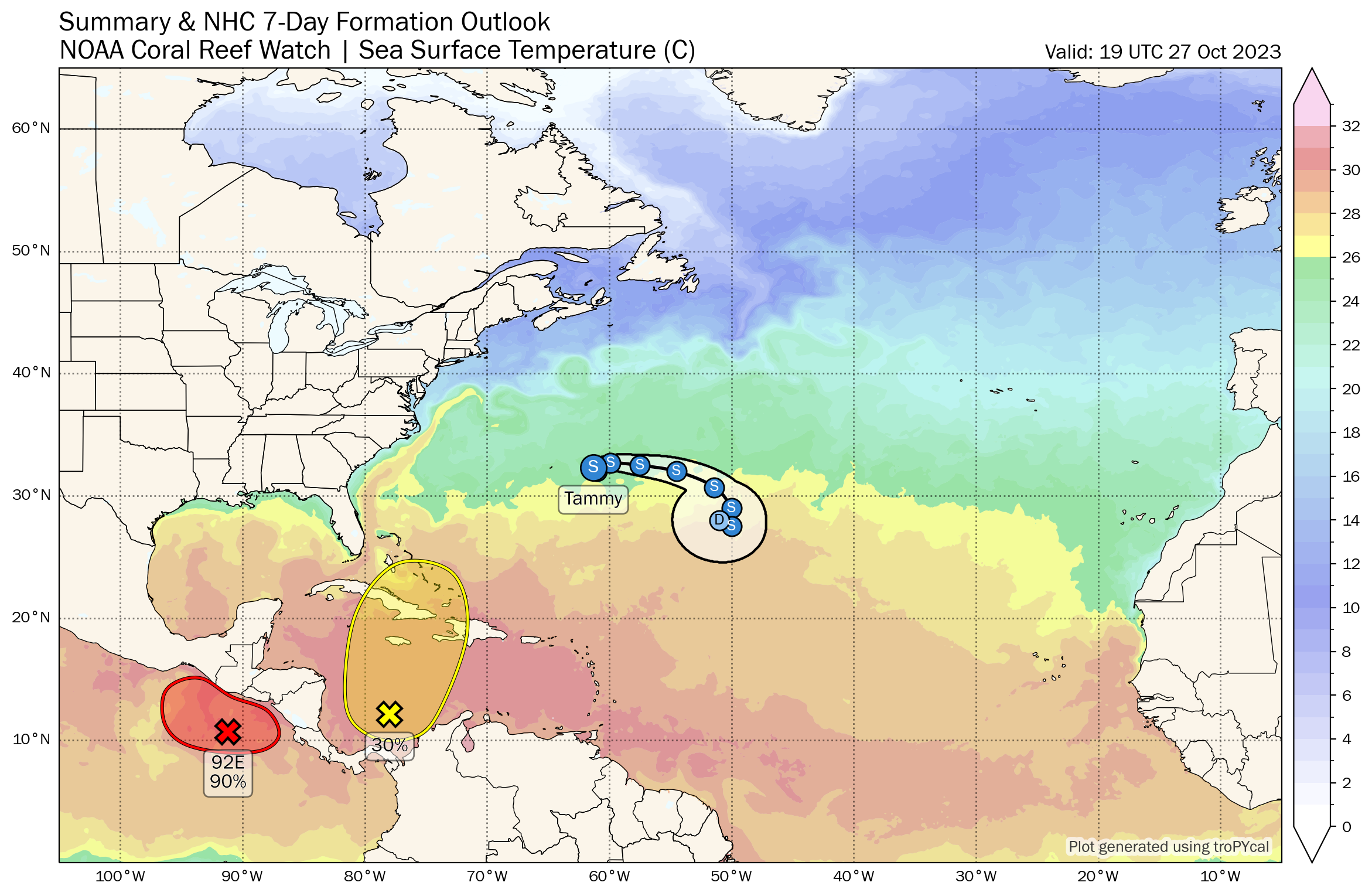
TROPICS: Tammy is a tropical storm again in the Atlantic, about 200 miles east of Bermuda. It will move slowly eastward, staying far from land through early next week.
And, a broad area of low pressure has formed over the southwestern Caribbean Sea. Environmental conditions could support some slow development of this system during the next several days while it moves generally northward. NHC gives this feature a 30 percent chance of development over the next seven days.
ON THIS DATE IN 1940: A late season heat wave was underway across the Deep South thanks to a strong upper high. Birmingham’s high was 88 degrees, which still stands as the daily record high for October 27.
ON THIS DATE IN 2006: An F1 tornado (waterspout) came ashore and caused significant damage on the west side of Apalachicola Florida.
Look for my next video briefing here by 6:00 a.m. Monday… enjoy the weekend!
Category: Alabama's Weather, ALL POSTS
About the Author (Author Profile)
James Spann is one of the most recognized and trusted television meteorologists in the industry. He holds the AMS CCM designation and television seals from the AMS and NWA. He is a past winner of the Broadcast Meteorologist of the Year from both professional organizations.Subscribe
If you enjoyed this article, subscribe to receive more just like it.


