Midday Nowcast: Dry and Warm October Weather
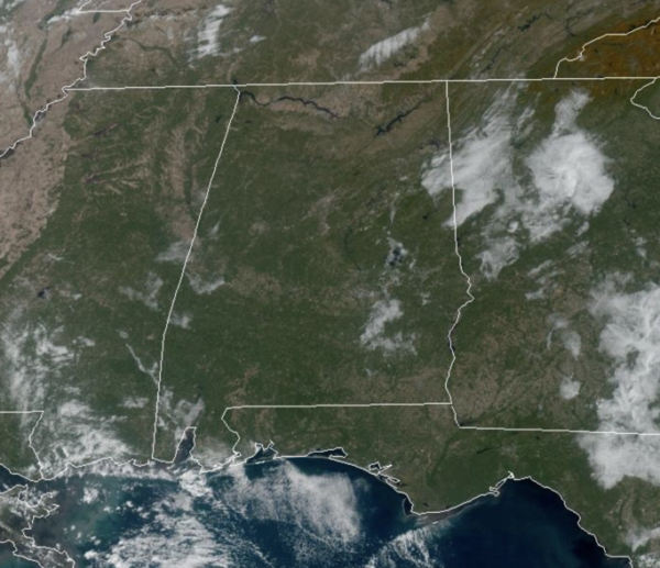
An upper ridge and surface high pressure remain firmly in control of the weather across the Deep South. Our weather will remain dry through the weekend. Expect mainly sunny, warm days and clear and cool nights. Temperatures will be in the upper 70s to mid 80s through the weekend, while nights will range from the mid 50s to lower 60s.
With the lack of rain, drought conditions will continue to intensify. Due to low relative humidity values/dry air in place as well as the dry soil, fires will be able to start easily today. Dispose of cigarettes properly, avoid leaving fires unattended, avoid dragging chains, and don’t do any outdoor burning.
FIRE ALERT: The Alabama Forestry Commission (AFC) re-issued a Fire Alert for all 67 counties in the state yesterday. In the 32 northern counties (roughly north of Interstate 20), no burn permits will be issued. In the 35 southern counties (south of Interstate 20), certified prescribed burn managers will have the option to obtain a one-day burn permit. There will be no exceptions to this rule. Anyone who burns a field, grassland, or woodland without a burn permit may be subject to prosecution for committing a Class B misdemeanor.
FOOTBALL WEATHER: The sky will be clear for the high school games across Alabama Friday night with temperatures falling from the mid 70s at kickoff into the upper 60s by the quarter.
For Saturday’s Magic City Classic in Birmingham (Alabama State vs Alabama A&M, 2:30p CT kickoff at Legion Field)… the sky will be partly to mostly sunny with temperatures in the low to mid 80s. It will be a warm October afternoon.
Auburn hosts Mississippi State (2:30p CT kickoff) at Jordan Hare Stadium… dry and warm weather is the story with temperatures in the 80-83 degree for most of the game. The sky will be mostly sunny.
NEXT WEEK: A cold front will arrive late Monday and into Halloween Tuesday. A few light rain showers are possible, but it won’t be big rain event with rainfall totals less than one-quarter inch. Behind the front, the coolest air so far this season will roll into the state late Monday and into Tuesday. Highs will drop into the 50s and 60s, while lows will hold fall into the 30s and 40s. Many locations across North Alabama, will likely see the first freeze of the season.
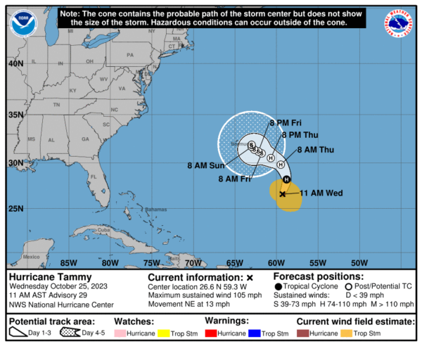
IN THE TROPICS: Hurricane Tammy is moving toward the northeast near 13 mph. A northward turn is expected later today, followed by a slower northwestward to west-northwestward motion on Thursday and Friday. Maximum sustained winds have increased to near 105 mph with higher gusts. Gradual weakening is expected for the next few days. Tammy is forecast to become a powerful post-tropical cyclone by Thursday. Hurricane-force winds extend outward up to 25 miles from the center and tropical-storm-force winds extend outward up to 175 miles. The estimated minimum central pressure is 965 mb (28.50 inches).
The rest of the basin is quiet. Hurricane season ends November 30th and the remaining names on list this year are Vince and Whitney.
BEACH FORECAST CENTER: Get the latest weather and rip current forecasts for the beaches from Fort Morgan to Panama City on our Beach Forecast Center page. There, you can select the forecast of the region that you are interested in visiting.
WORLD TEMPERATURE EXTREMES: Over the last 24 hours, the highest observation outside the U.S. was 108.5F at Matam, Senegal. The lowest observation was -80.3F Vostok, Antarctica.
CONTIGUOUS TEMPERATURE EXTREMES: Over the last 24 hours, the highest observation was 94F at Falcon Village, TX. The lowest observation was 11F at Polebridge, MT.
Category: Alabama's Weather, ALL POSTS


