Midday Nowcast: Friday Front with Clouds and Light Rain
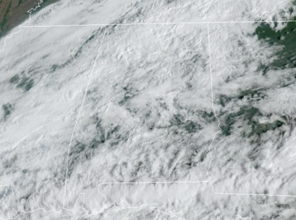
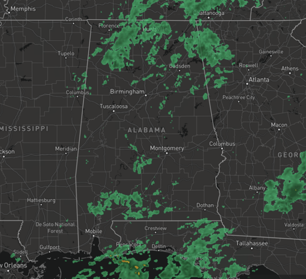
A strong cold front is passing through the state today, and is the reason for the clouds and areas of scattered light rain on the radar. With limited moisture, beneficial rainfall just won’t happen as rainfall totals of less than a quarter of inch are expected.
Certainly not the kind of rain we need, but some locations could see enough to settle the dust. Highs today across the state are ranging from the mid 70s to mid 80s. The rain will exit and the sky will clear tonight with lows falling into the low 50s for most locations.
FRIDAY NIGHT LIGHTS: For the high school games tonight, a few widely scattered showers are possible across East and South Alabama. Otherwise mostly cloudy with temperatures falling through the 60s with a fairly stiff north breeze.
FANTASTIC FALL WEATHER: Later tonight, as the front exits the state, the coolest air so far this season will roll into Alabama. Tomorrow will be breezy as a brisk, north wind will be blowing in the cooler air. Highs will drop into the mid to upper 60s 60s and low 70s, with lows in the 40s Sunday and Monday mornings. Some of the colder spots, could see some upper 30s. It will be downright chilly, and you will need those jackets out the door in the morning hours. We expect a good supply of sunshine both Saturday and Sunday.
FOOTBALL WEATHER: Tomorrow, Alabama will be in College Station to take on Texas A&M (2:30p CT kickoff). About 72 degrees at kickoff with a mostly sunny sky. It will be a very pleasant afternoon.
UAB will host USF tomorrow at Protective Stadium in downtown Birmingham (3:00p CT kickoff). The sky will be sunny with temperatures falling from near 67 at kickoff, into low 60s by the final whistle. The afternoon will be breezy with a north wind of 10-20 mph.
Troy will host Arkansas State (3p CT kickoff)… expect sunshine in full supply with a kickoff temperature near 72 degrees.
NEXT WEEK: Most of next week looks generally rain-free with a slow warming trend. Highs early in the week will be in the 70s, but should reach the 80s by Thursday or Friday. Towards the end of the week, we have increasing confidence in a low moving along the Gulf Coast, and that would spread rain north into the state. Certainly some much needed rain, if it occurs as rainfall potential could be in the 1”-2” range.
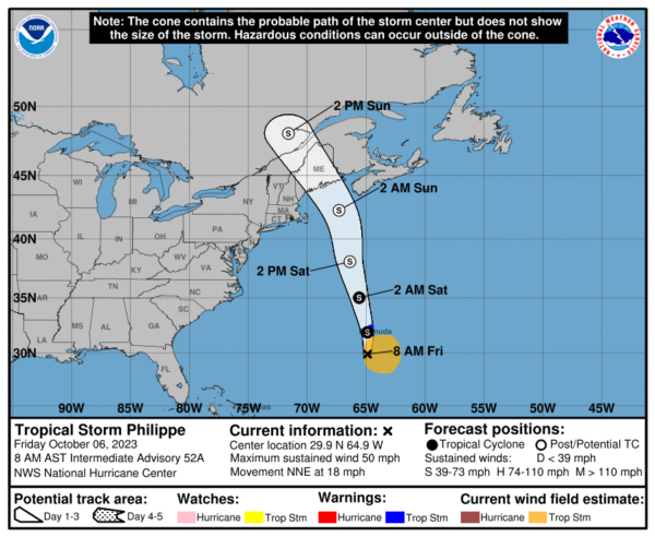
IN THE TROPICS: Tropical Storm Philippe is moving toward the north-northeast near 18 mph. A general northward motion with a further increase in forward speed is expected through Saturday night. A turn toward the north-northwest is forecast by early Sunday. On the forecast track, the center of Philippe will pass near Bermuda later today, and then reach the coast of Nova Scotia, New Brunswick, or eastern Maine Saturday night into Sunday.
Maximum sustained winds are near 50 mph with higher gusts. Some strengthening is possible over the next day or so, but Philippe is expected to become post-tropical on Saturday. Tropical-storm-force winds extend outward up to 175 miles from the center. An elevated surface observing station at the National Museum of Bermuda recently reported a sustained wind of 46 mph and a gust to 57 mph. The estimated minimum central pressure is 1003 mb (29.62 inches).
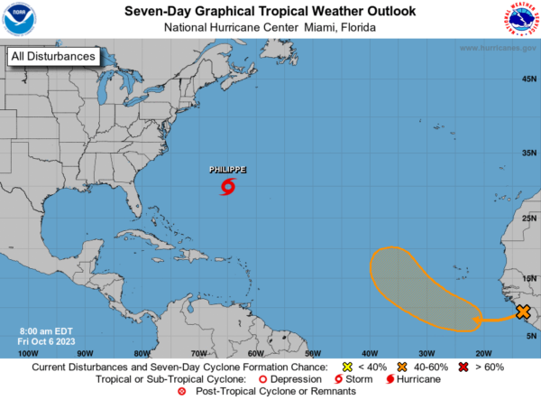
Well to the east, a low-latitude tropical wave is expected to move off the west coast of Africa later today and tonight. Thereafter, environmental conditions appear generally conducive for gradual development of the system, and a tropical depression could form by the early to middle part of next week while it moves westward to west-northwestward across the eastern tropical Atlantic. Formation chance through 7 days…medium…50 percent.
The remaining names on list this year are Sean, Tammy, Vince, and Whitney.
BEACH FORECAST CENTER: Get the latest weather and rip current forecasts for the beaches from Fort Morgan to Panama City on our Beach Forecast Center page. There, you can select the forecast of the region that you are interested in visiting.
WORLD TEMPERATURE EXTREMES: Over the last 24 hours, the highest observation outside the U.S. was 124.5F at Siteki, Eswatini. The lowest observation was -96.7F Vostok, Antarctica.
CONTIGUOUS TEMPERATURE EXTREMES: Over the last 24 hours, the highest observation was 102F at Mecca, CA. The lowest observation was 19F at Angel Fire, NM.
Category: Alabama's Weather, ALL POSTS


