Midday Nowcast: Sunny and Very Warm
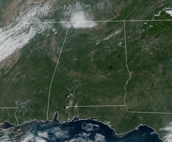
Tons of sunshine in the Alabama sky today and that will continue most of this week. The weather will stay dry through Thursday with highs in the mid to upper 80s, a few spots could touch 90° during the afternoon hours. Nights will remain fair and pleasant with lows in the 60s.
HERE COMES FALL: A strong cold front will pass through the state Friday bringing clouds and possibly a few sprinkles or patches of light rain. Unfortunately with limited moisture the chance of beneficial rain is very low, and most of Alabama will remain dry. Behind the front, the coolest air so far this season will roll into Alabama just in time for the weekend. Highs will drop into the upper 60s and low 70s, with lows in the 40s early Sunday over the northern half of the state. We expect a good supply of sunshine both Saturday and Sunday. A picture perfect, fall weekend of weather for Alabama.
NEXT WEEK: At this point, next week looks generally rain-free with a slow warming trend; highs reach the 80s by Thursday or Friday. Still no signs of any major rain event for Alabama for the next ten days. Again, October is statistically our driest month of the year in Alabama, but we sure could use some rain!
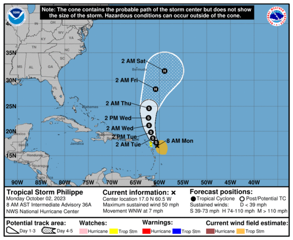
IN THE TROPICS: We only have one system in the Atlantic currently…Philippe. The center of Tropical Storm Philippe was located by an Air Force Reserve Hurricane Hunter aircraft near latitude 17.0 North, longitude 60.5 West. Philippe is moving toward the west-northwest near 7 mph, and a northwestward motion is expected to resume later today through early Tuesday. A turn toward the north-northwest is forecast to occur by late Tuesday, followed by a northward motion on Wednesday. On the forecast track, the center of Philippe is expected to pass near or just northeast of the northern Leeward Islands later today and tonight.
Maximum sustained winds remain near 50 mph with higher gusts. Little change in strength is forecast during the next day or so, but Philippe could begin to intensify more significantly around the middle of the week. Tropical-storm-force winds extend outward up to 175 miles, primarily east and southeast of the center. The estimated minimum central pressure is 998 mb (29.47 inches).
The rest of the basin is quiet with no tropical development expected the next seven days. The remaining names on list this year are Sean, Tammy, Vince, and Whitney.
BEACH FORECAST CENTER: Get the latest weather and rip current forecasts for the beaches from Fort Morgan to Panama City on our Beach Forecast Center page. There, you can select the forecast of the region that you are interested in visiting.
WORLD TEMPERATURE EXTREMES: Over the last 24 hours, the highest observation outside the U.S. was 111.9F at Ouallene, Algeria. The lowest observation was -91.5F Concordia, Antarctica.
CONTIGUOUS TEMPERATURE EXTREMES: Over the last 24 hours, the highest observation was 102F at Rio Grande Village, TX. The lowest observation was 21F at Kirk, OR.
Category: Alabama's Weather, ALL POSTS


