Friday Evening Update on Invest 93L; Depression Likely By the End of the Weekend
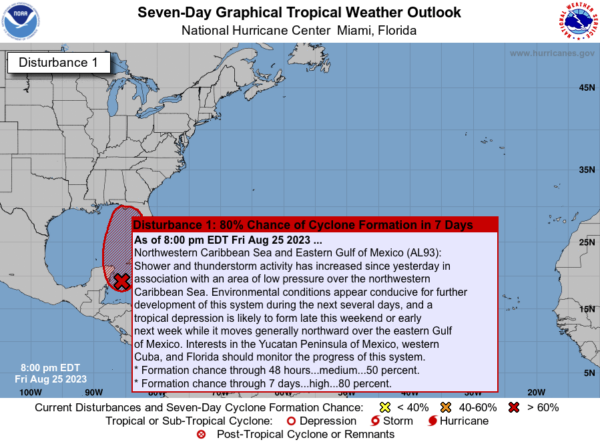
The 7 pm update from the NHC recently came out and here is what the latest outlook says on INVEST 93L which will be making its way toward the Northern Gulf Coast.
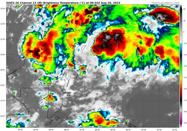
Shower and thunderstorm activity has increased since yesterday in association with an area of low pressure over the northwestern Caribbean Sea. Environmental conditions appear conducive for further development of this system during the next several days, and a tropical depression is likely to form late this weekend or early next week while it moves generally northward over the eastern Gulf of Mexico. Interests in the Yucatán Peninsula of Mexico, western Cuba, and Florida should monitor the progress of this system.
* Formation chance through 48 hours…medium…50 percent.
* Formation chance through 7 days…high…80 percent.
The tropics have been quiet for quite a while, especially with any activity over the Gulf of Mexico. That is actually bad news because water temperatures are approaching 90º just right offshore of Panama City back to Pensacola, and even back to Gulf Shores and Ft. Morgan.
For now, the main model ensembles have shown that a tropical storm will be most likely, and it will move across the extreme eastern parts of the Florida Panhandle to as far south as the south-central Florida Peninsula. As Spann said in his afternoon video briefing, once this thing becomes better organized, we’ll be able to have better model data and give a much better idea on landfall possibilities, storm strength, storm surge heights, and rainfall projections.
I’ll have updates through the weekend, including on my Saturday Morning Briefing which will be out by 7 am.
Category: Alabama's Weather, ALL POSTS, Tropical


