Midday Nowcast: Still Sizzling
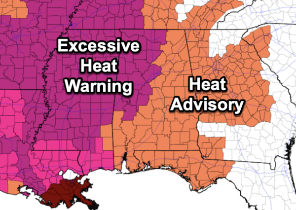
Our weather remains mostly dry and very hot today and through the weekend as afternoon highs will range from 95°-103° across Alabama. Heat index values are in the 105°-115° range, and an excessive heat warning and heat advisories are in effect today and tomorrow, and these will likely continue Sunday.
A few isolated, pop-up afternoon storms are possible each afternoon or evening, but rain chances are only about 20%, meaning most locations will remain dry.
FOOTBALL WEATHER: FOOTBALL WEATHER: For the first week of high school football, tonight will be a very warm, humid night across Alabama. An isolated storm can’t be totally ruled out, otherwise the sky will be mostly fair with temperatures falling through the 80s during the games.
Tomorrow, Jacksonville State hosts the University of Texas at El Paso (4:30p CT kickoff) at Burgess-Snow Field; the weather will be very hot with an outside risk of a brief shower or storm during the game. Expect a kickoff temperature near 96 degrees, falling into the upper 80s by the final whistle.
FINALLY A PATTERN CHANGE: As the ridge shifts west, a surface front will drop into Alabama on Monday, causing our heat levels to fall, and scattered showers and thunderstorms to become more numerous Monday and Tuesday. Highs drop into the 80s over the northern half of the state, and low 90s over South Alabama. A drier, continental airmass is expected to push into the state over the latter half of the week with lower humidity and cooler nights…many spots across North/Central Alabama are expected to reach the 50s by Thursday and Friday morning for that first true, hint of fall. By the way, fall officially arrives in 29 days, on September 23rd.
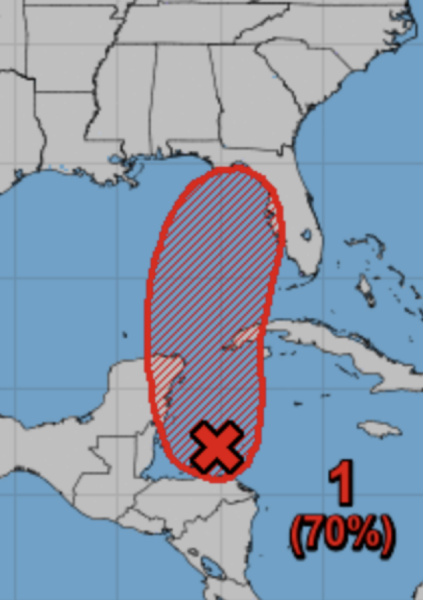
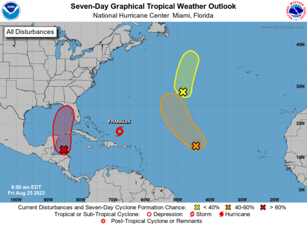
IN THE TROPICS: All eyes are focused to the south as tropical troubles are brewing in the Caribbean, and this feature is Gulf bound early next week. The broad area of low pressure over the northwestern Caribbean Sea is producing disorganized showers and thunderstorms. Environmental conditions appear conducive for gradual development of this system during the next several days, and a tropical depression is likely to form late this weekend or early next week while moving generally northward over the northwestern Caribbean Sea and eastern Gulf of Mexico. Formation chance through 7 days…high…70 percent.
Of course we are keeping an eye on this feature as it will be in the Gulf, and way too early to know any specifics. If a depression or storm develops, global models suggest it will move over the northern Florida peninsula at mid-week; this track will keep Alabama on the dry side of the system, with the main impact to the southeast. We will have much better clarity once the system gets a well defined low level center in a day or two. If this becomes a storm, more than likely it will be the “I” name, Idalia, pronounced ee-DAL-ya.
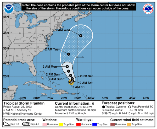
Elsewhere in the tropics, Tropical Storm Franklin is moving toward the east-northeast near 6 mph and this general motion is expected to continue today. A sharp turn toward the north is expected tonight and Saturday, with a northward or north-northwestward motion over the western Atlantic continuing through early next week. Maximum sustained winds remain near 60 mph. Gradual strengthening is forecast, and Franklin will likely become a hurricane over the weekend, and will be the second hurricane of the season in the Atlantic with Don being the first. The system is not expected to impact the U.S. as it drifts northward between the East Coast and Bermuda.
The remnants of Emily and another tropical wave in the Atlantic have low chances of development, but if they do, they will not impact land and remain over the open waters of the Atlantic.
BEACH FORECAST CENTER: Get the latest weather and rip current forecasts for the beaches from Fort Morgan to Panama City on our Beach Forecast Center page. There, you can select the forecast of the region that you are interested in visiting.
WORLD TEMPERATURE EXTREMES: Over the last 24 hours, the highest observation outside the U.S. was 125.6F at Basrah International Airport, Iraq. The lowest observation was -102.3F Vostok, Antarctica.
CONTIGUOUS TEMPERATURE EXTREMES: Over the last 24 hours, the highest observation was 112F at Bleakwood, TX and Tecopa, CA. The lowest observation was 29F at Bynum, MT.
Category: Alabama's Weather, ALL POSTS


