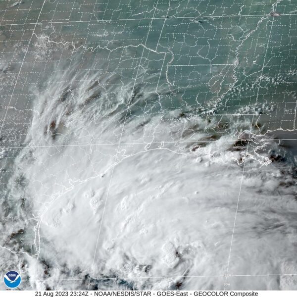
PTC Nine Officially Becomes a Depression
Satellite data and data from the Hurricane Hunters indicated there was sufficient organization for the disturbance in the western Gulf of Mexico to officially be classified as a tropical depression.
The system is expected to reach tropical storm strength later tonight or Tuesday morning and it will become Harold.
A Tropical Storm Warning is in effect for…
* Mouth of Rio Grande to Port O’Connor, Texas
A Tropical Storm Watch is in effect for…
* Port O’Connor to Sargent, Texas
It should move inland on the Lower Texas Coast tomorrow morning with top winds between 45-55 mph. Tropical storm force winds will reach the coast around 7 a.m. between Port Mansfield and Corpus and spread across the area from Rockport to Ports Mansfield during the morning. Ot should weaken rapidly after landfall.
It will bring beneficial rains to South Texas. The depression is expected to produce rainfall amounts of 3 to 5 inches, with isolated higher amounts of 7 inches, across South Texas on Tuesday and Wednesday. Areas of flash flooding will be possible.
Surge will be 1-3 feet from the Mouth of Rio Grande to Sargent, including Baffin Bay, Corpus
Christi Bay and Matagorda Bay.
A couple of tornadoes are possible across south Texas on Tuesday.
Large swells generated by the depression will affect portions of southern Texas tonight through Tuesday. These swells are likely to cause life-threatening surf and rip current conditions. Please consult products from your local weather office.
Category: Alabama's Weather, ALL POSTS, Tropical


