Alabama Update at 12:30 p.m.
It is an easy update on this Sunday afternoon.
Skies are mostly clear north of I-20, with a few fair weather cumulus clouds over the southern two thirds of the area.
Temperatures are in the upper 80s to lower 90s at this hour.
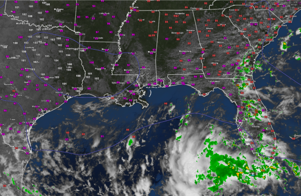
The nearest rain to Alabama is showers and storms along the coasts of South Carolina, Georgia, and Northeast Florida. They are associated with an onshore flow from a high pressure ridge which covers the western Atlantic onshore into the Mid-Atlantic.
A trough of low pressure is moving through the southeastern Gulf of Mexico. Lots of clouds and showers associated with it. This disturbance may develop as it moves western across the Gulf of Mexico toward the Lower Texas Coast. We could see a tropical depression or even a tropical storm form by the time it moves inland over southeastern Texas Tuesday. It is no threat to the northern Gulf Coast, although rip currents will be high through tomorrow night.
You can see the ridge of high pressure over eastern Texas and Louisiana. It will be what keeps the tropical system to the south. Yesterday, Alexadnria LA recorded 110F, smashing the record high for the date by 6 degrees and establishing the highest temperature ever recorded there.
Austin Camp Mabry TX is already at 97F. They will certainly hit 100 degrees again for the 44th consecutive day as they keep adding to that record. The old record was 27 days.
Category: Alabama's Weather, ALL POSTS, Tropical


