Midday Nowcast: Another Alabama Scorcher
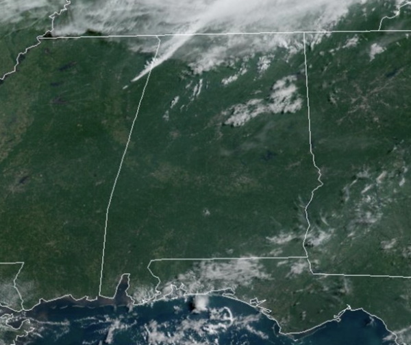
Highs this afternoon are in the mid and upper 90s across much of North Central Alabama. Dewpoints remain high, mid to upper 70s, and the continued combination of hot temperatures and high humidity are causing heat index values to surge into the 110°-115° range again this afternoon. Another Excessive Heat Warning is in effect for nearly the entire state of Alabama again today. Like recent days, Big HEAT means Big STORMS, and during the peak heating of the days, a few scattered storms will fire up; lightning and gusty winds are the main threats with any storms this afternoon and evening.
We also note, the SPC has defined a “marginal risk” (level 1/5) of severe thunderstorms for the far northern counties of Alabama late today and tonight for storms along and in advance of a surface front.
REST OF THE WEEK: The surface front will push through Alabama tomorrow, and scattered storms remain possible mainly for the southern 2/3 of the state south of the front. An airmass change begins over North Alabama with highs dropping into the mid to upper 80s. South Alabama remains hot and humid with highs in the 90s. A drier, continental air pushes deep into the state by Wednesday. Humidity levels will be lower, highs will be under 90° over the northern half of the state, and we start the day with lows in the 60-65 degree range across the northern and central counties. And, because of the dry air we won’t have to deal with summer storms, with the exception of areas near the Gulf Coast.
WEEKEND WEATHER: Dry weather will continue to be the story for most of the state through the weekend; any scattered storms will be confined to the far southern counties of Alabama. Heat levels rise, and by the weekend all of the state will see highs back in the mid 90s with humidity levels creeping up as well. Rolling into next week, the upper level ridge intensifies over the Deep South, bringing hot and mostly dry weather to the Alabama. Any showers and storms will remain fairly isolated. Highs will be well into the 90s.
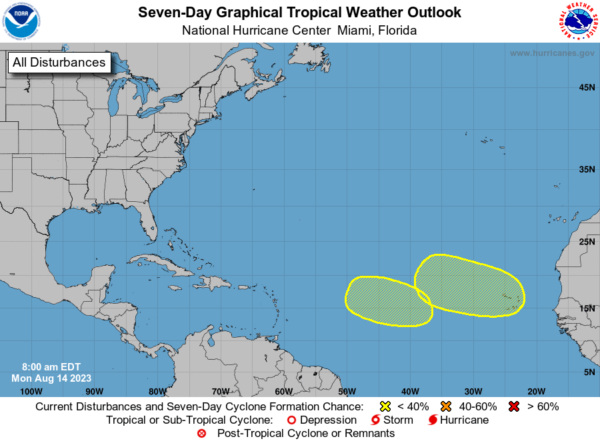
IN THE TROPICS: Way far east in the Eastern Tropical Atlantic, a tropical wave is forecast to move off the west coast of Africa on Wednesday or early Thursday. Some slow development of this system will be possible late this week while the system moves gradually west-northwestward or northwestward across the eastern Atlantic. Formation chance through 7 days…low…30 percent.
In the Central Tropical Atlantic, another area of low pressure could develop by the middle to latter portion of this week over the central tropical Atlantic. Some slow development of this system is also possible while it moves west-northwestward through the end of the week. Formation chance through 7 days…low…20 percent.
The next few names up are Emily, Franklin, and Gert.
BEACH FORECAST CENTER: Get the latest weather and rip current forecasts for the beaches from Fort Morgan to Panama City on our Beach Forecast Center page. There, you can select the forecast of the region that you are interested in visiting.
WORLD TEMPERATURE EXTREMES: Over the last 24 hours, the highest observation outside the U.S. was 126.3F at Khanaqin, Iraq. The lowest observation was -105.7F Vostok, Antarctica.
CONTIGUOUS TEMPERATURE EXTREMES: Over the last 24 hours, the highest observation was 116F at Death Valley, CA. The lowest observation was 24F at Foxpark, WY.
Category: Alabama's Weather, ALL POSTS


