
Sunday Early Afternoon Update: Heat Indices Are Really High
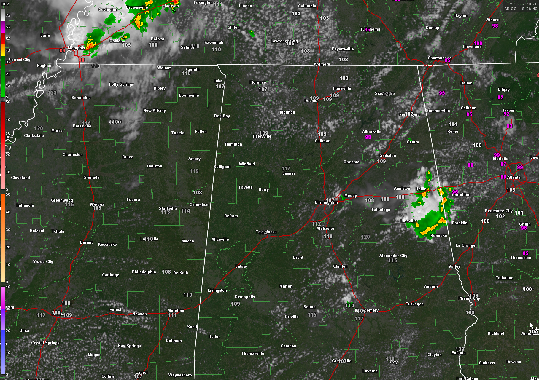
Mostly sunny and hot across much of North and Central Alabama early on this Sunday afternoon, with the exception of a small disturbance that has been producing a few showers across parts of northern Jefferson, Cullman, Blount, and St. Clair Counties over the past few hours. That activity has pushed into East Central Alabama and now cover parts of Cleburne, Clay, and Randolph Counties. They will move into Georgia shortly.
Highs are soaring through the lower and middle 90s across the area. Heat index values are very high, 107F at Birmingham 110F at Calera, 112F at Bessemer. 117F at Dannelly Field. 109F at Huntsville. 120F at Sylacauga.
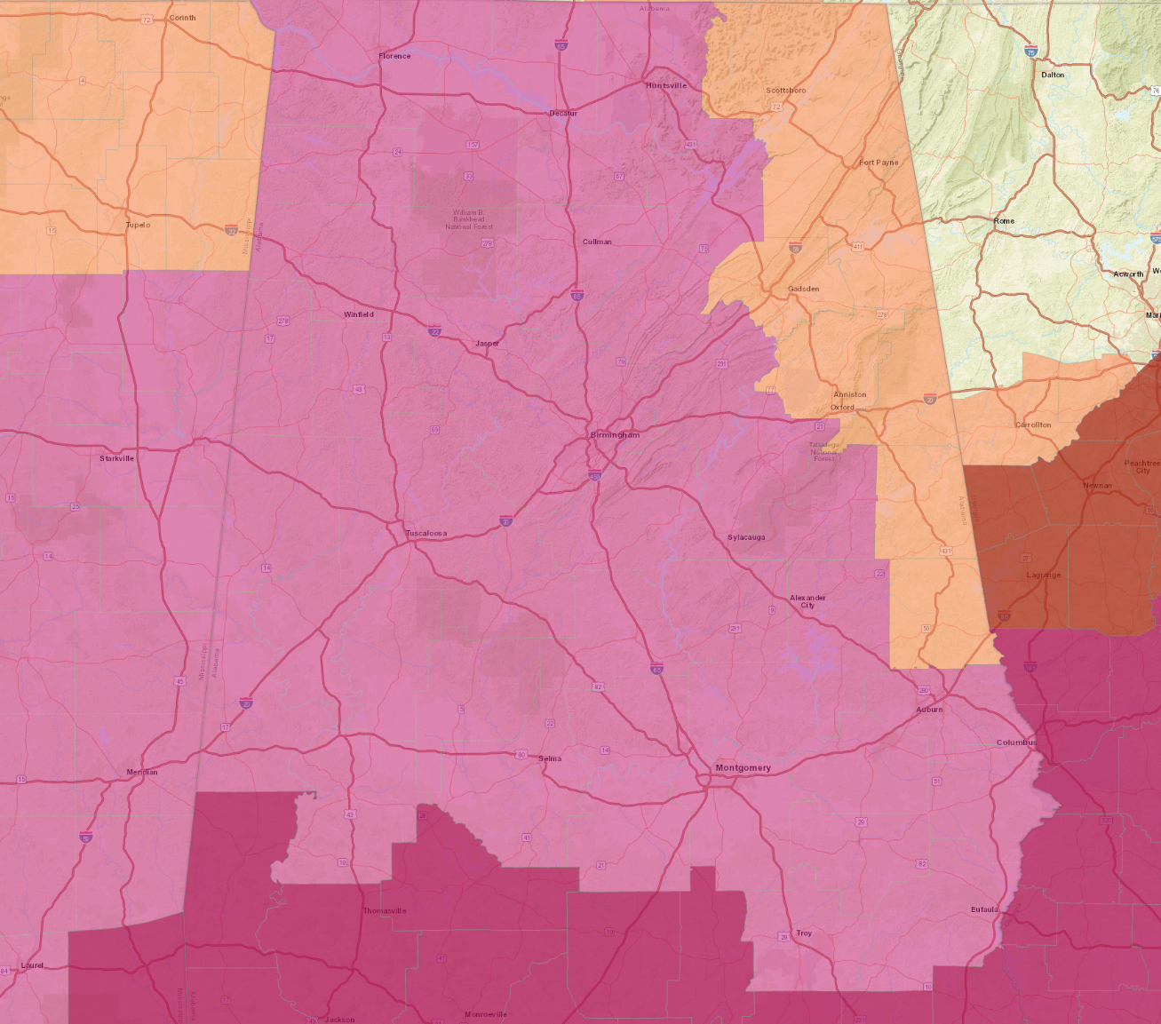
Either Heat advisories or Excessive Heat Warnings are in effect until 9 p.m. this evening for all of the state. Birmingham has extended its Excessive Heat Warning and heat Advisory through Monday evening. Heat index values between 105-109 in the advisory areas and 110-113F in the warning areas. Since this graphic was completed, Chambers County has been added to the Excessive Heat Warning.
A good bit of model inconsistency, but it appears we will deal with only widely scattered afternoon and evening showers and storms today, except in the Tennessee valley, where the trailing edge of a re-intensifying MCS may drag through those North Alabama Counties this afternoon and early this evening. There are SPC Risks (marginal and slight) up there and we can’t rule out a severe thunderstorm watch again, but the SPC has been putting the chance at only 40%. The WRF thinks the storms could come down into the I-20 Corridor from Birmingham east to Georgia. We will be watching.
Tomorrow will feature more of the same. Hot and humid with excessive heat indices. Looks like mostly widely scattered afternoon and evening showers and storms for us. Another MCS pushes by to our north. The storms could become a little more numerous during the afternoon in the I-85 Corridor. Looks like a cool front pushes through during the day on Tuesday leading to drier weather for the remainder of the week. Highs on Wednesday might top out in the 80s. Morning lows Wednesday-Friday may be in the 60s! Looks like we will be done with heat advisories and warnings from Wednesday into the weekend.
Category: Alabama's Weather, ALL POSTS, Severe Weather
About the Author (Author Profile)
Bill Murray is the President of The Weather Factory. He is the site's official weather historian and a weekend forecaster. He also anchors the site's severe weather coverage. Bill Murray is the proud holder of National Weather Association Digital Seal #0001 @wxhistorianSubscribe
If you enjoyed this article, subscribe to receive more just like it.


