The Late-Morning Report — I’m Sweating Buckets & It’s Not Even Midday; Severe T-Storm Watch Issued
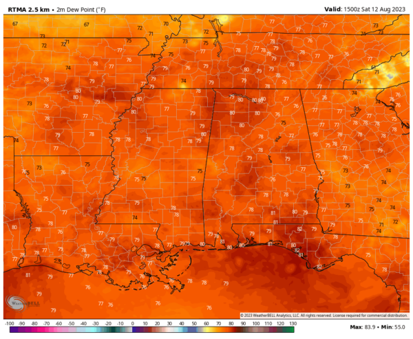
Isn’t it bad that when you get out of your car and walk a short distance to the front door of your local grocery store, you start breaking a sweat? So much so, that you have to take a cool shower as soon as you get back home? I’m about to have to take a shower because that just happened to me. You want to know why? The above image are dewpoint values as of 10 am this morning. Several locations had a dewpoint reading of above 80º, while the rest of the area saw mid to upper 70s in dewpoints. You mix that with temperatures already in the mid to upper 80s across much of the area, and heat index values are already up to 92-108º. Selma is at 88º with an 82º dewpoint, raising the heat index to 108º. Excessive heat warnings are up for much of Central Alabama, with the rest of the area and nearly all of North Alabama are under a Heat Advisory. Where do we look for relief?
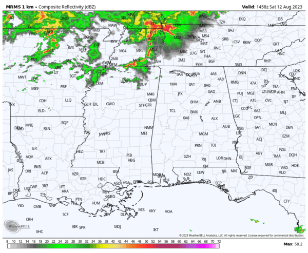
The Southeastern Composite Radar valid at 10 am shows rain and thunderstorms just off to our north and northeast, and eventually those will move southeastward into North and Central Alabama, bringing some relief from the heat with them. What price will we have to pay?
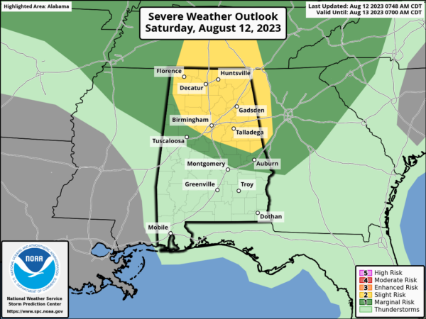
The answer is in the form of a threat of strong to severe thunderstorms with the potential of damaging winds and quarter-size hail. A Slight Risk (level 2/5) has been introduced across nearly all of North Alabama and a good portion of the northern half of Central Alabama. A Marginal Risk (level 1/5) is up for the rest of North Alabama and stretches several miles south of the Slight Risk in Central Alabama. The main window for the threat will be from roughly 1 pm to 9 pm from northwest to southeast.
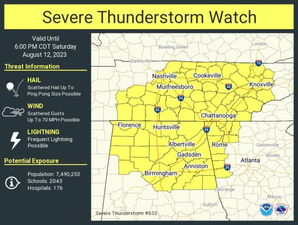
A Severe Thunderstorm Watch has just been issued until 6 pm this evening for Colbert, Cullman, DeKalb, Franklin, Jackson, Lauderdale, Lawrence, Limestone, Madison, Marshall, and Morgan counties in North Alabama, and for Blount, Calhoun, Cherokee, Clay, Cleburne, Etowah, Fayette, Jefferson, Marion, Randolph, Shelby, St. Clair, Talladega, Walker, and Winston counties in Central Alabama.
Instability rates will be very high once again, approaching 5,000 J/kg by the late afternoon hours, and mixing that with plenty of humidity and just enough wind shear, for the threat of damaging downdrafts and hail large enough to meet severe criteria.
Just remember, the soil is very wet from the continuous barrage of daily storms, so the threat is there for strong winds to knock down trees and cause power outages and damage to homes and other properties. We’ll be with you through the afternoon and evening with updates and when/if watches and/or warnings are issued.
Category: Alabama's Weather, ALL POSTS, Severe Weather


