Saturday Weather Briefing — Strong/Severe Storms Possible This Afternoon
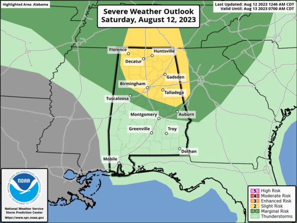
We are staring off this morning dry across all of Central Alabama for the first time in a few days, but more rain and storms are expected later today, some of which may be strong to severe. A Slight Risk (level 2/5) has been introduced across nearly all of North Alabama and a good portion of the northern half of Central Alabama. A Marginal Risk is up for the rest of North Alabama and stretches several miles south of the Slight Risk in Central Alabama. The main window for the threat will be from roughly 1 pm to 9 pm from northwest to southeast. Damaging winds up to 60 mph and hail up to quarter size are the threats from any severe storm.
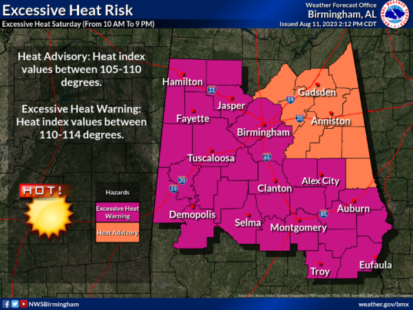
We’ll also have to be careful outdoors before the storms as heat index levels could reach as high as 105º to 114º. All of North Alabama except for Jackson and DeKalb counties is under a Heat Advisory, along with the northeast quarter of Central Alabama. The rest of Central Alabama is under an Excessive Heat Warning. Both of these go from 10 am this morning to 9 pm tonight. Highs will range from the lower 90s to the lower 100s.
Sunday will feature very hot conditions once again along with high humidity levels, and the heat products may be issued once again across the area. We’ll have a chance of a few isolated to scattered showers and storms across the area, but at this point, there is no defined risk of severe weather. Highs in the mid 90s to the lower 100s.
No change on Monday… hot, humid, with a chance of a few isolated to scattered afternoon showers and storms. Highs in the mid 90s to the lower 100s.
A front will push through the area on Tuesday, but the better dynamics will remain well off to the north from us. We’ll have a chance of a few isolated to scattered afternoon showers and storms. Highs in the mid 80s to the upper 90s from north to south.
On Wednesday, it will feel much more comfortable outdoors as dewpoints will drop back into the 60s. We’ll actually be dry throughout the day across Central Alabama and highs in the lower 80s to the lower 90s.
The heat levels will start increasing on Thursday, but at this point, dewpoints look to stay lower. It will be another dry day across the area with highs in the upper 80s to the mid 90s.
And at the end of the forecast period on Friday… The airmass across the southeast will become more humid and that will introduce the chance of a few isolated to scattered afternoon showers and storms. Highs in the upper 80s to the mid 90s.
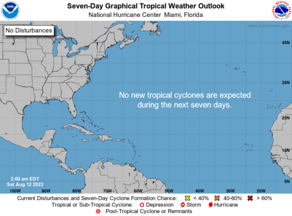
The tropics remain very quiet surprisingly as we are in the peak of the hurricane season. No new tropical cyclones are expected to form throughout the next seven days.
Category: Alabama's Weather, ALL POSTS, Severe Weather, Tropical, Weather Xtreme Videos


