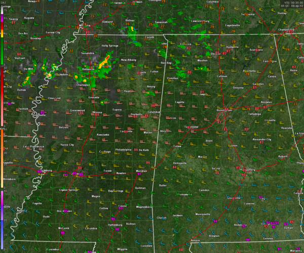
Storms Forming Over Mississippi, Marginal Risk of Severe Weather Overnight
A surface boundary to our north, a flow of warm, moist air from the southwest thanks to high pressure over the Gulf, and an approaching upper level disturbance are conspiring to produce an area of showers and storms tonight that extends from eastern Arkansas across northern Mississippi and into northwestern Alabama. The overall coverage and intensity seems to be slowly increasing but they are still well below severe limits. That could change though with time with a decent amount of instability still over Alabama, but relatively low, but not non-existent wind shear.
These storms will travel west to east overnight and slowly sink to the south again as the front sags southward. There is a chance for a few isolated wind damage reports from the stronger storms. I wouldn’t anticipate a severe weather watch, bit a few warnings are possible.
The storms should be moving into South Central Alabama and gradually weakening after 2 a.m. The threat will be until about 11 pm in our northwestern counties, and between about 10pm-4am across the rest of Central Alabama. The threat south of Montgomery looks very small.
We could see another round of showers and storms mainly over South Central Alabama Friday afternoon.
We will be monitoring the weather through the evening hours and into the early morning if necessary so stay tuned.
Category: Alabama's Weather, ALL POSTS, Severe Weather


