First Severe Threat Winding Down;Another One Expected in Here After Midnight
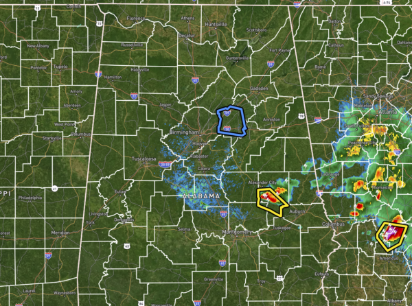
As of 10:45 pm, other than the severe warned thunderstorm over portions of Tallapoosa County, the rest of Central Alabama is rather quiet. However, more storms are off to our northeast and are expected to move through the northern half of Central Alabama during the overnight and pre-dawn hours of Thursday morning. The Severe Thunderstorm Watch has been allowed to expire as the threat of severe weather has ended for those counties for now.
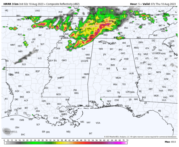
The latest HRRR model run shows a line of storms moving into the northwest corner of the state around 1-2 am and will move east-southeastward through the northern half of Central Alabama and all of North Alabama. There will be some shear and helicity mixed in with the instability as this wave moves in, so damaging winds, large hail, and even a brief tornado will be possible roughly from midnight until 6 am.
And the storms don’t look like they will be stopping until around mid-afternoon, but another cluster of storms looks to form back into Mississippi and move into the area by early evening. Once again, there is a risk for strong to severe storms with damaging winds as the main threat.
Have a way to receive warnings during the night and pre-dawn hours… One that will wake you up if your location goes under a warning, so you and your family can get to your place of safety.
Category: Alabama's Weather, ALL POSTS, Severe Weather


