Severe Storms Pushing Southeast
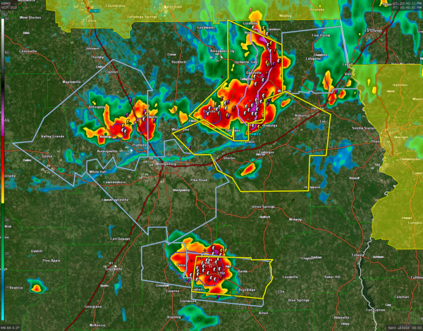
Our severe thunderstorms continue to push southeast this afternoon and are maintaining their strength as they continue to plow into extremely unstable air.
Here are the main concerns at 5:50:
…Severe thunderstorm warning for Elmore, Lee and Macon Counties until 645 pm. This warning includes everything along I-85 between Shorter and Opelika including Auburn and Tallassee.
…Those storms are moving our of Elmore and Tallapoosa Counties where a severe thunderstorm warning remains in effect until 615 pm. These are the strongest storms in the state now, affecting areas from New Site down to Camp Hill and back to Eclectic.
…Strong storms entering the Montgomery area. They are not severe at this time but could intensify as they enter this amazingly unstable airmass. It is currently 99/77 at Dannelly Field, and CAPE values are running near 4,000 joules/kg.
…Strong storms in the Troy area. Lightning rates are jumping with this storm and it will likely become severe. In fact, it just did. Severe thunderstorm warning for Pike County until 645 pm. 60 mph wind gusts possible along with small hail.
The northeastern Alabama storms are no longer severe. The airmass is full worked over in that part of the state.
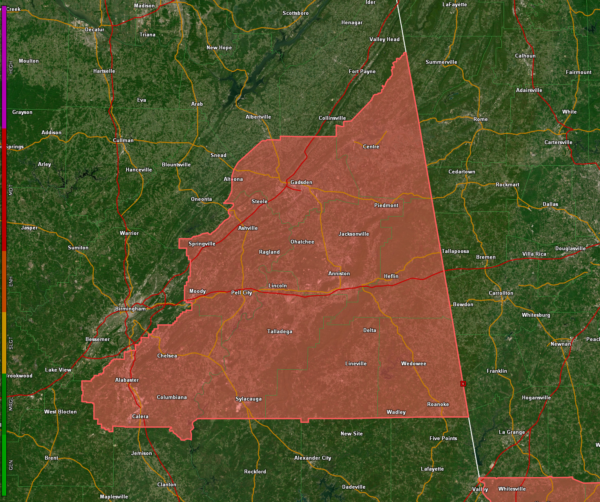
Here are counties still in the watch, but I think most of them will be cleared soon and the watch totally canceled. No indications that a new watch will replace the current one for counties further south.
Category: Alabama's Weather, ALL POSTS, Severe Weather


