An Update on the Severe Weather Threat for Today and Tomorrow
Severe weather is possible across Alabama this afternoon and evening and again Monday as an active weather pattern continues across the Southeast. The greatest threat is from damaging winds, although there could be a few reports of quarter sized hail as well. The storms will be accompanied by dangerous lightning as well as torrential rain. A woman was struck by lightning in her home in Walker County on Thursday. She survived the experience fortunately.
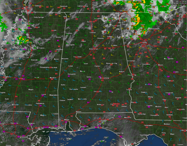
SUNDAY MORNING COMIN’ DOWN: A few showers and storms moved through the Tennessee Valley Counties of North Alabama during the late night and early morning hours. They were heaviest over the Northeast Alabama counties of Jackson, Marshall, DeKalb, and Cherokee. Outside of the storms, skies have been partly cloudy and it is humid. Temperatures were racing through the 80s heading for highs in the lower and middle 90s.
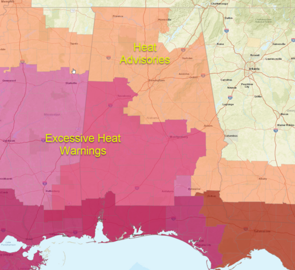
HEAT ADVISORIES: Heat advisories and excessive heat warnings are in effect for all but the far northeastern counties of Alabama where temperatures have been held back a bit by the morning rainfall.
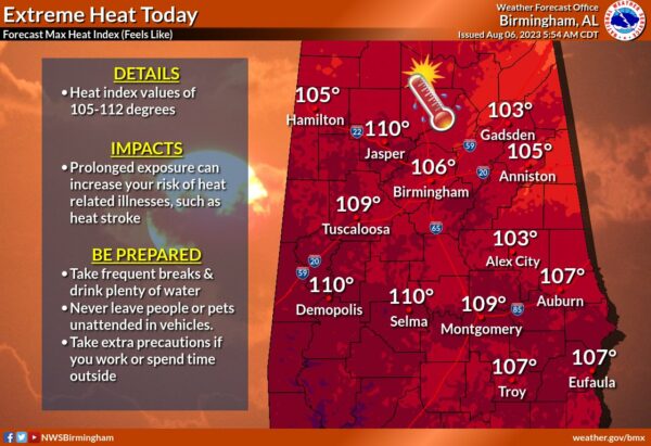
Apparent temperatures will reach the 103-110F range across the rest of Central and North Alabama and approach 115F over South Alabama.
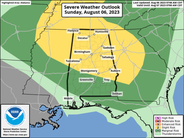
SEVERE WEATHER THREAT RAMPED UP A BIT: The SPC expanded their Day One slight risk area (level 2 out of 5) to include more of Central Alabama on the 8 a.m. update. The slight risk includes areas as far south as Demopolis, Hayneville, and Eufaula. Very high levels of instability, including substantial amounts of downdraft CAPE, which supports the threat of damaging wind gusts are possible across Alabama this afternoon and evening. The threat will begin as early as 1 p.m. in the Northwest, and spread slowly southeast. The threat will reach the I-59 Counties by 2 p.m. and our east central counties as early as 3 p.m. The threat will continue until about 7 p.m in the Northwest and 9 p.m. around Auburn.
TORNADOES POSSIBLE TO OUR NORTH: The SPC is even concerned about the possibility of tornadoes well to our north over parts of Iowa, Missouri, Illinois, Indiana and Kentucky. The highest threat is over southern Illinois.
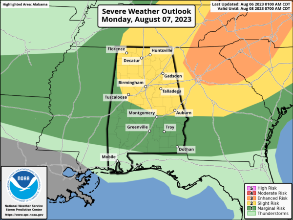
MONDAY ACTIVE TOO: More storms will warm in the hot, sticky airmass across Alabama on Monday, again moving northwest to southeast mainly during the afternoon. With high temperatures again in the lower and middle 90s, and dewpoints in the middle 70s, there will be plenty of fuel for the storms. Throw in an approaching boundary and a little extra shear, and severe weather is again possible. The SPC has a slight risk out for the northern half of Alabama on Monday, with a marginal risk for much of the rest of the state. Heat index values will be in the dangerous category again, so look for heat advisories to be issued once again for Monday.
THE REST OF THE WEEK: Indications are that the lower pressure across the northern tier of states will help push Monday’s boundary southward into South Alabama on Tuesday, lowering our temperatures a couple of degrees and the apparent temperatures enough to drop eliminate the need for heat advisories. Highs will be between 89-90F Tuesday through Friday, with storm limited to South Central and South Alabama on Tuesday. The boundary will be around into mid-week with the potential for passing disturbances to bring rounds of showers and storms Wednesday and Thursday, most likely during the evening hours.
Category: Alabama's Weather, ALL POSTS, Severe Weather


