Midday Nowcast: Storm Chances Increase Rest of Week
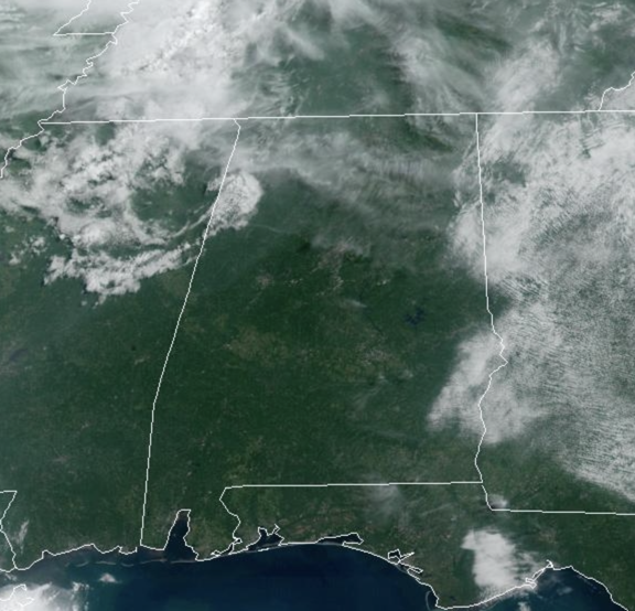
Today we are seeing more sunshine than clouds and rain chances remain low, but not zero for much of North/Central Alabama. Temperatures are in the low to mid 90s this afternoon. After today, rain chances begin to increase as we watch the “Ring of Fire” pattern across the U.S. We are on the edge of the big heat dome to our west, and complexes of storms will move around the edge of ridge, and these will move into Alabama in the coming days, and some of these storms could be strong to locally severe.
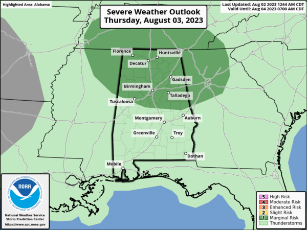
For tomorrow, the SPC has the northern half of Alabama in a “marginal risk” (level 1 of 5) of severe storms as one of these complexes is expected to move into Alabama with the risk of damaging winds and/or a brief-tornado; we will keep an eye on the radar through the day tomorrow.
Besides the threat of an MCS, air mass thunderstorms will be possible each day tomorrow and through the weekend. Again, these are random and you just have to watch radar trends, especially between the hours of 2PM-10PM, when we see the greatest activity on the radar. Temperatures should be in the low to mid 90s for much of North/Central Alabama, and with higher humidity, heat index values will climb into the triple digits, and possibly over 105° which means more heat advisories may be issued across portions of Alabama.
ACROSS THE USA: Flash flooding concerns today aided by tropical moisture and a stationary frontal boundary will focus showers and thunderstorms over parts of Iowa, Missouri and Illinois. To the south of this rainfall, dangerous to record breaking heat will expand across the South and Southwest. The heat, gusty winds and low humidity levels could result in rapid spread of wildfires across the Southern Plains.
INTO NEXT WEEK: For now, it doesn’t look like the weather pattern for the second week of August will be much different than the first week. Scattered afternoon showers and storms will be possible on each afternoon to early evening. Highs will generally be in the low to mid 90s.
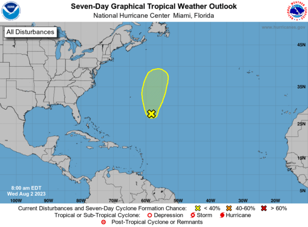
IN THE TROPICS: In the Central Tropical Atlantic Invest 96L is an area of showers and thunderstorms remain disorganized in association with a low pressure area located about 475 miles southeast of Bermuda. Environmental conditions are becoming increasingly less favorable for tropical cyclone formation, and the low is expected to move northward and merge with a frontal system over the north-central Atlantic in a couple of days. Formation chance through 7 days…low…10 percent.
BEACH FORECAST CENTER: Get the latest weather and rip current forecasts for the beaches from Fort Morgan to Panama City on our Beach Forecast Center page. There, you can select the forecast of the region that you are interested in visiting.
WORLD TEMPERATURE EXTREMES: Over the last 24 hours, the highest observation outside the U.S. was 125.6F at Basrah-Hussen, Iraq. The lowest observation was -94.2F Dome A, Antarctica.
CONTIGUOUS TEMPERATURE EXTREMES: Over the last 24 hours, the highest observation was 114F at Death Valley, CA. The lowest observation was 31F at Bynum, MT.
Category: Alabama's Weather, ALL POSTS


